| Karawatha Forest | |
|---|---|
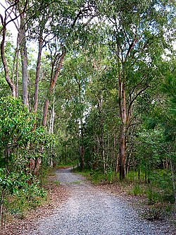
 Forest track | |
 | |
| Type | Nature reserve |
| Nearest city | Brisbane, Queensland, Australia |
| Operated by | Brisbane City Council |
| Open | Open all year |
Karawatha Forest or Karawatha nature reserve is approximately 900 hectares of bushland in the Brisbane suburbs of Karawatha and Stretton, Australia. It is one of the largest areas of remnant bushland within Brisbane.[1] The predominant vegetation types in the forest are dry eucalypt forest and woodland with native heath understories.[2] The Karawatha Forest Protection Society was formed to ensure that the bushland was protected from development and is owned and managed by the Brisbane City Council (BCC). Funds raised from the BCC's Bushland Preservation Levy have enabled the acquisition of land for preservation of Karawatha Forest.[3]
The subtropical bushland reserve contains an important wetland area along Scrubby Creek and an unnamed creek, both of which flow into Slacks Creek, tributary of the Logan River. Significant landmarks within the forest include Poet's Rock, the Old Quarry, Curtisii (formerly Paratz) Lookout, "the Rocks," Frog Hollow and the Illaweena Lagoon system. Along the western edge of the forest is the Gateway Motorway.
The reserve was first declared in 1906.[4]
- ^ "Karawatha Forest Park". Brisbane City Council. Retrieved 2 March 2015.
- ^ Cite error: The named reference
geacwas invoked but never defined (see the help page). - ^ "Bushland Preservation Levy". Brisbane City Council. 13 March 2015. Retrieved 10 October 2015.
- ^ Howells, Mary (2006). Ridge to Ridge: Recollections from Woodridge to Park Ridge. Logan City Council. p. 141. ISBN 0-9750519-2-X. Archived from the original on 2 November 2021. Retrieved 2 November 2021.
© MMXXIII Rich X Search. We shall prevail. All rights reserved. Rich X Search
