Back Kembata Alaba Tembaro Zone CEB Kembata French Kembata Timbaro Italian Strefa Kembata Tembaro Polish Kembata Alaba Tembaro Swedish 坎巴塔滕巴羅地區 Chinese Kembata Tembaro Zone Zulu

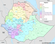
Kembata is a zone in the Central Ethiopia Regional State of Ethiopia. It was formerly known as Kembata, Alaba and Tembaro, until Alaba and Tembaro became a special woreda in 2002 and 2023 respectively.[1] This zone is named after the Kambaata people[2] which gained zonal posture following the establishment of Central Ethiopian region in 2023.[3]
The zone is bordered on the south by Wolayita, on the southwest by Dawro, on west by Tembaro special woreda, on the northwest by Hadiya, on the north by Gurage, on the east by the Alaba special woreda, and on the southeast by an exclave of the Hadiya Zone. The administrative center is Durame; other important towns include Shinshicho. Other local landmarks include the three mountains of Ambaricho, Kataa, and Datoo, and the hot springs at Motokoma. The longest river in the area is the Lagabora which in Kambaata means the "river of Bora".
Kembata has 217 kilometers of all-weather roads and 140 kilometers of dry-weather roads, for an average road density of 249 kilometers per 1000 square kilometers.[4] The Central Statistical Agency (CSA) reported that 8,364 tons of coffee were produced in Gurage, Hadiya and Kembata in the year ending in 2005, based on inspection records from the Ethiopian Coffee and Tea authority. This represents 8.33% of the SNNPR's output and 3.36% of Ethiopia's total output.[5]
- ^ Names and codes for January 2000, Ethiopia (WHO website). The information in the WHO spreadsheet is built on information received 18 September 2002 from the Ethiopian Ministry of Federal Affairs.
- ^ Treis, Yvonne (2012). A Grammar of Kambaata, Part 1. Cologne: Rüdiger Köppe Verlag.
- ^ Joswig, Andreas (2020). "Language Standardization Dilemmas in the Ethiopian Context". In Van der Waal, Jenneke; Smits, Heleen; Petrollino, Sara; Nyst, Victoria; Kossmann, Maarten (eds.). Essays on African Languages and Linguistics in Honour of Maarten Mous. Leiden: Leiden University: African Studies Center. p. 89. ISBN 978-90-5448-186-7.
- ^ "Detailed statistics on roads" Archived 2011-07-20 at the Wayback Machine, SNNPR Bureau of Finance and Economic Development website (accessed 3 September 2009)
- ^ CSA 2005 National Statistics Archived 2006-11-23 at the Wayback Machine, Table D.2
© MMXXIII Rich X Search. We shall prevail. All rights reserved. Rich X Search