Back مقاطعة كيواوني (ويسكونسن) Arabic Kewaunee County, Wisconsin BAR Киуаний (окръг, Уисконсин) Bulgarian কিৱাউনে কাউন্টি, উইসকনসিন BPY Kewaunee Gông (Wisconsin) CDO Kewaunee County CEB کاونێ کاونتی، ویسکۆنسن CKB Kewaunee County, Wisconsin Welsh Kewaunee County German Kantono Kewaunee Esperanto
Kewaunee County | |
|---|---|
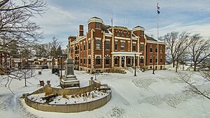
 Kewaunee County Courthouse | |
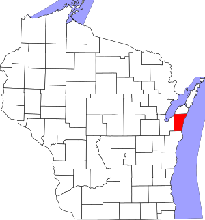
 Location within the U.S. state of Wisconsin | |
 Wisconsin's location within the U.S. | |
| Coordinates: 44°35′N 87°26′W / 44.59°N 87.44°W | |
| Country | |
| State | |
| Founded | 1859 |
| Seat | Kewaunee |
| Largest city | Algoma |
| Area | |
| • Total | 1,084 sq mi (2,810 km2) |
| • Land | 343 sq mi (890 km2) |
| • Water | 742 sq mi (1,920 km2) 68% |
| Population | |
| • Total | 20,563 |
| • Density | 60.0/sq mi (23.2/km2) |
| Time zone | UTC−6 (Central) |
| • Summer (DST) | UTC−5 (CDT) |
| Congressional district | 8th |
| Website | www |
Kewaunee County is a county located in the U.S. state of Wisconsin. As of the 2020 census, the population was 20,563.[2] Its county seat is Kewaunee.[3] The county was created in 1852 and organized in 1859.[4] Its Menominee name is Kewāneh, an archaic name for a species of duck.[5] Kewaunee County is part of the Green Bay, WI Metropolitan Statistical Area as well as the Green Bay-Shawano, WI Combined Statistical Area.
- ^ Cite error: The named reference
2020-census-55061was invoked but never defined (see the help page). - ^ "State & County QuickFacts". United States Census Bureau. Archived from the original on June 6, 2011. Retrieved January 21, 2014.
- ^ "Find a County". National Association of Counties. Archived from the original on May 31, 2011. Retrieved June 7, 2011.
- ^ "Wisconsin: Individual County Chronologies". Wisconsin Atlas of Historical County Boundaries. The Newberry Library. 2007. Archived from the original on April 14, 2017. Retrieved August 14, 2015.
- ^ Hoffman, Mike. "Menominee Place Names in Wisconsin". The Menominee Clans Story. Retrieved October 5, 2018.
© MMXXIII Rich X Search. We shall prevail. All rights reserved. Rich X Search