Back منطقة خلونج توي Arabic খেত খলোং তোয়েই BPY Khet Khlong Toei CEB Khlong Toei German Khlong Toei Spanish Khlong Toei Estonian Khlong Toei French Khlong Toei Italian クローントゥーイ区 Japanese 클롱뜨이 Korean
This article needs additional citations for verification. (April 2021) |
Khlong Toei
คลองเตย | |
|---|---|
 View of Khlong Toei from Asok intersection toward Nana | |
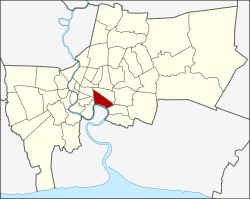
 Khet location in Bangkok | |
| Coordinates: 13°42′29″N 100°35′2″E / 13.70806°N 100.58389°E | |
| Country | Thailand |
| Province | Bangkok |
| Seat | Khlong Toei |
| Khwaeng | 3 |
| Khet established | 9 November 1989 |
| Area | |
| • Total | 13.0 km2 (5.0 sq mi) |
| Population (2017) | |
| • Total | 102,945[1] |
| • Density | 7,918.84/km2 (20,509.7/sq mi) |
| Time zone | UTC+7 (ICT) |
| Postal code | 10110 except parts of Phra Khanong: 10260 |
| Geocode | 1033 |
Khlong Toei (also Klong Toey, Thai: คลองเตย, pronounced [kʰlɔ̄ːŋ tɤ̄ːj]) is a district in central Bangkok, long known for its slum. It is bordered by the Chao Phraya River and contains major port facilities. It is also the site of a major market, the Khlong Toei Market.
Neighboring districts are (clockwise from the north): Watthana, Phra Khanong, Phra Pradaeng district of Samut Prakan province (across the Chao Phraya), Yan Nawa, Sathon, and Pathum Wan.
- ^ "Population and House Report for Year 2017 (see page 2 for data of this district)". Department of Provincial Administration, Ministry of Internal Affairs. Retrieved 2018-04-01. (Search page)
© MMXXIII Rich X Search. We shall prevail. All rights reserved. Rich X Search