Back কোশি তপু বন্যপ্রাণী সংরক্ষণাগার Bengali/Bangla Koshi Tappu Wildlife Reserve CEB Koshi Tappu Wildlife Reserve German कोशी टप्पु वन्यजन्तु आरक्ष DTY Reserva natural de Koshi Tappu Spanish Riserva naturale Koshi Tappu Italian कोशी टप्पु वन्यजन्तु आरक्ष MAI कोशी टप्पु वन्यजन्तु आरक्ष Nepali Rezerwat Przyrody Koshi Tapu Polish
| Koshi Tappu Wildlife Reserve | |
|---|---|
| कोशी टप्पु वन्यजन्तु आरक्ष | |
IUCN category IV (habitat/species management area) | |
 Koshi River | |
| Location | Nepal |
| Nearest city | Inaruwa |
| Coordinates | 26°39′N 87°0′E / 26.650°N 87.000°E |
| Area | 176 km2 (68 sq mi) |
| Established | 1976 |
| Governing body | Department of National Parks and Wildlife Conservation (Nepal) |
| Website | https://dnpwc.gov.np/ |
| Official name | Koshi Tappu |
| Designated | 17 December 1987 |
| Reference no. | 380[1] |
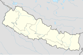
The Koshi Tappu Wildlife Reserve is a protected area in the Terai of eastern Nepal covering 176 km2 (68 sq mi) of wetlands in the Sunsari, Saptari and Udayapur Districts. It comprises extensive reed beds and freshwater marshes in the floodplain of the Kosi River, and ranges in elevation from 75 to 81 m (246 to 266 ft). It was established in 1976 and designated as a Ramsar site in December 1987. It hosts Nepal's last remaining herd of the wild water buffalo (Bubalus arnee).[2]
- ^ "Koshi Tappu". Ramsar Sites Information Service. Retrieved 25 April 2018.
- ^ Bhuju, U. R.; Shakya, P. R.; Basnet, T. B. & Shrestha, S. (2007). Nepal Biodiversity Resource Book. Protected Areas, Ramsar Sites, and World Heritage Sites. Kathmandu: International Centre for Integrated Mountain Development, Ministry of Environment, Science and Technology, in cooperation with United Nations Environment Programme, Regional Office for Asia and the Pacific. ISBN 978-92-9115-033-5.
© MMXXIII Rich X Search. We shall prevail. All rights reserved. Rich X Search


