Back لاکرسنتا-مونتروز، کالیفورنیا AZB La Crescenta-Montrose Catalan Ла-Кресента-Монтроуз (Калифорни) CE La Crescenta-Montrose CEB La Crescenta-Montrose German La Crescenta-Montrose Spanish La Crescenta-Montrose (Kalifornia) Basque لاکرسنتا-مونتروز، کالیفرنیا Persian La Crescenta-Montrose French La Crescenta-Montrose (Kalifornija) Croatian
This article needs additional citations for verification. (May 2019) |
La Crescenta-Montrose, California | |
|---|---|
|
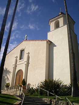
Top: Holy Redeemer Catholic Church; Bottom: Mt. Lukens | |
 | |
| Coordinates: 34°13′30″N 118°14′13″W / 34.22500°N 118.23694°W | |
| Country | |
| State | |
| County | |
| Area | |
| • Total | 3.437 sq mi (8.902 km2) |
| • Land | 3.426 sq mi (8.873 km2) |
| • Water | 0.011 sq mi (0.029 km2) 0.32% |
| Elevation | 1,540 ft (469.392 m) |
| Population (2010) | |
| • Total | 19,653 |
| • Density | 5,700/sq mi (2,200/km2) |
| Time zone | UTC−8 (PST) |
| • Summer (DST) | UTC−7 (PDT) |
| ZIP Codes | 91214 (La Crescenta) 91020 (Montrose) |
| Area code(s) | 747 and 818 |
| FIPS code | 06-39045 |
La Crescenta-Montrose () is an unincorporated area in Los Angeles County, California, United States. The community is bordered by Glendale to the south and west, La Cañada Flintridge to the east, and Angeles National Forest to the north.[2] According to the United States Census Bureau, the La Crescenta-Montrose Census-Designated Place (CDP) measures about 3.4 square miles (8.8 km2), and the population was 19,997 at the 2020 census, up from 19,653 in 2010 and 18,532 in 2000.[3]
- ^ "U.S. Census". Archived from the original on January 25, 2012. Retrieved December 7, 2017.
- ^ Cite error: The named reference
La Crescenta-Montrosewas invoked but never defined (see the help page). - ^ "U.S. Census Bureau QuickFacts: La Crescenta-Montrose CDP, California". www.census.gov. Retrieved July 16, 2022.
© MMXXIII Rich X Search. We shall prevail. All rights reserved. Rich X Search

