Back جزيرة السيدة إليوت Arabic Lady Elliot Island CEB Lady Elliot Czech Lady-Elliot-Insel German Insulo Lady Elliot Esperanto Île Lady Elliot French Lady Elliot Island Italian レディーエリオット島 Japanese ലേഡി ഇലിയറ്റ് ഐലൻഡ് Malayalam Lady Elliot Island Dutch
 Lady Elliot Island as seen from the air | |
| Geography | |
|---|---|
| Location | Coral Sea |
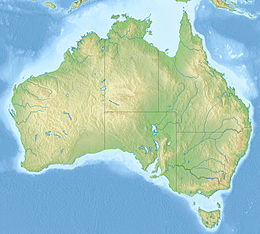
| Coordinates | 24°07′S 152°43′E / 24.117°S 152.717°E |
| Archipelago | Capricorn and Bunker Group |
| Area | 0.69 km2 (0.27 sq mi) |
| Administration | |
Australia | |
| Region | Central Queensland |

Lady Elliot Island is the southernmost coral cay of the Great Barrier Reef, Australia. The island lies 46 nautical miles (85 km; 53 mi) north-east of Bundaberg and covers an area of approximately 45 hectares (110 acres). It is part of the Capricorn and Bunker Group of islands and is owned by the Commonwealth of Australia. The island is home to a small eco resort and an airstrip, which is serviced daily by flights from Bundaberg, Hervey Bay, Brisbane and the Gold Coast.
Lady Elliot Island is located within the 'Green Zone' of the Great Barrier Reef Marine Park, which is the highest possible classification designated by the Great Barrier Reef Marine Park Authority. Marine National Park Green Zones protect the biodiversity within the Great Barrier Reef Marine Park by protecting important breeding and nursery areas such as seagrass beds, mangrove communities, deepwater shoals and reefs.[1]
The island is particularly renowned for its scuba diving and snorkelling, as its location far offshore at the southern end of the Great Barrier Reef results in excellent water clarity.
- ^ Interpreting zones. GBRMPA. Retrieved on 2 May 2022.
© MMXXIII Rich X Search. We shall prevail. All rights reserved. Rich X Search

