Back Lake Superior Provincial Park CEB Parc provincial du Lac-Supérieur French Lake Superior Provincial Park Swedish
| Lake Superior Provincial Park | |
|---|---|
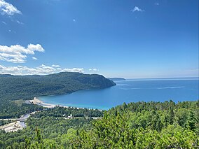
 Old Woman Bay | |
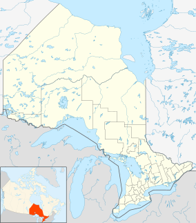
| Location | Algoma District, Ontario |
| Nearest city | Wawa |
| Coordinates | 47°35′48″N 84°44′29″W / 47.59667°N 84.74139°W[1] |
| Area | 155,646 ha (600.95 sq mi) |
| Established | 1944 |
| Governing body | Ontario Parks |
| www | |

Lake Superior Provincial Park is one of the largest provincial parks in Ontario, covering about 1,550 square kilometres (600 sq mi) along the northeastern shores of Lake Superior between Sault Ste. Marie and Wawa in Algoma District in Northeastern Ontario, Canada.[1] Ontario Highway 17 (at this point part of the Trans-Canada Highway) now runs through the park. When the park was established by Ontario in 1944, there was no road access.
- ^ a b "Lake Superior Provincial Park". Geographical Names Data Base. Natural Resources Canada. Retrieved 2011-11-05.
© MMXXIII Rich X Search. We shall prevail. All rights reserved. Rich X Search
