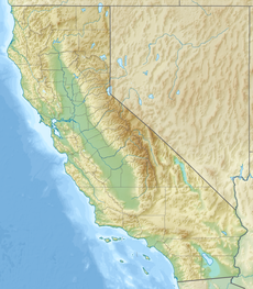
Back Ласен-Пік Byelorussian Lassen Peak CEB Lassen Peak Czech Lassen Peak German Monto Lassen Esperanto Pico Lassen Spanish Lassen Peak Estonian Lassen Peak Finnish Pic Lassen French לאסן HE
| Lassen Peak | |
|---|---|
 Lassen Peak volcano | |
| Highest point | |
| Elevation | 10,457 ft (3,187 m) NAVD 88[1] |
| Prominence | 5,229 ft (1,594 m)[2] |
| Listing | |
| Coordinates | 40°29′17″N 121°30′18″W / 40.48806°N 121.50500°W[1] |
| Geography | |
| Location | Shasta County, California, U.S. |
| Parent range | Cascade Range |
| Topo map | USGS Lassen Peak |
| Geology | |
| Age of rock | Less than 27,000 years |
| Mountain type | Lava dome |
| Volcanic arc | Cascade Volcanic Arc |
| Last eruption | 1914 to 1921 |
| Climbing | |
| Easiest route | Hike |
Lassen Peak (/ˈlæsən/ LASS-ən),[3] commonly referred to as Mount Lassen, is a 10,457 ft (3,187 m) lava dome volcano in Lassen Volcanic National Park in Northern California. Located in the Shasta Cascade region above the northern Sacramento Valley, it is the southernmost active volcano in the Cascade Range of the Western United States, and part of the Cascade Volcanic Arc stretching from southwestern British Columbia to northern California. It supports many flora and fauna among its diverse habitats, which reach high elevations and are subject to frequent snowfall.
Lassen Peak has a volume of 0.6 cu mi (2.5 km3), making it one of the largest lava domes on Earth. The volcano arose from the former northern flank of now-eroded Mount Tehama about 27,000 years ago, from a series of eruptions over the course of a few years. The mountain has been significantly eroded by glaciers over the last 25,000 years, and is now covered in talus deposits.
On May 22, 1915, a powerful explosive eruption at Lassen Peak devastated nearby areas, and spread volcanic ash as far as 280 mi (450 km) to the east. This explosion was the most powerful in a series of eruptions from 1914 through 1917. Lassen Peak and Mount St. Helens in Washington were the only two volcanoes in the contiguous United States to erupt during the 20th century.
Lassen Volcanic National Park, which encompasses an area of 106,372 acres (430.47 km2), was created to preserve the areas affected by the eruption for future observation and study, to protect the nearby volcanic features, and to keep anyone from settling too close to the mountain. The park, along with the nearby Lassen National Forest and Lassen Peak, have become popular destinations for recreational activities, including climbing, hiking, backpacking, snowshoeing, kayaking, and backcountry skiing. Lassen Peak is dormant, meaning the volcano is merely inactive, and it has a functioning magma chamber under the ground still capable of eruptions. Thus it poses a threat to the nearby area through lava flows, pyroclastic flows, lahars (volcanically induced mudslides, landslides, and debris flows), ash, avalanches, and floods. To monitor this threat, Lassen Peak and the surrounding vicinity are closely observed with sensors by the California Volcano Observatory.
- ^ a b "Lassen". NGS Data Sheet. National Geodetic Survey, National Oceanic and Atmospheric Administration, United States Department of Commerce. Retrieved December 20, 2008.
- ^ "Lassen Peak, California". Peakbagger.com. Retrieved October 30, 2021.
- ^ "How to pronounce Lassen Volcanic National Park". Cambridge Dictionary. Retrieved December 16, 2022.
© MMXXIII Rich X Search. We shall prevail. All rights reserved. Rich X Search

