Back Lepontinische Alpen ALS جبال الألب ليبونتيني Arabic Лепанцінскія Альпы Byelorussian Лепонтински Алпи Bulgarian Alpi Lepontine CEB Lepontské Alpy Czech Lepontinische Alpen German Alpes Lepontinos Spanish Leponti Alpid Estonian Lepontiar Alpeak Basque
| Lepontine Alps | |
|---|---|
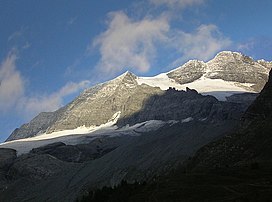
 Monte Leone | |
| Highest point | |
| Peak | Monte Leone |
| Elevation | 3,553 m (11,657 ft) |
| Coordinates | 46°24′N 8°08′E / 46.400°N 8.133°E |
| Naming | |
| Native name | |
| Geography | |
| Countries | Switzerland and Italy |
| Cantons, Regions | Valais, Ticino, Graubünden, Uri, Piedmont and Lombardy |
| Range coordinates | 46°25′N 8°40′E / 46.417°N 8.667°E |
| Parent range | Western Alps |
| Borders on | Pennine Alps, Bernese Alps, Uri Alps, Glarus Alps, Western Rhaetian Alps and Lugano Prealps |
| Topo map | Swiss Federal Office of Topography swisstopo |
| Geology | |
| Orogeny | Alpine orogeny |
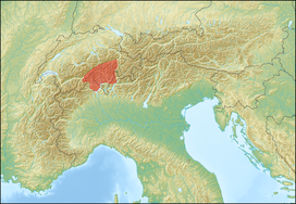
The Lepontine Alps (German: Lepontinische Alpen, French: Alpes lépontines, Italian: Alpi Lepontine) are a mountain range in the north-western part of the Alps. They are located in Switzerland (Valais, Ticino, Uri and Graubünden) and Italy (Piedmont and Lombardy).
The Simplon rail tunnel (from Brig to Domodossola), the Gotthard rail (from Erstfeld to Bodio) and Gotthard road tunnels (from Andermatt to Airolo) and the San Bernardino road tunnel are important transport arteries.
The eastern portion of the Lepontine Alps, from the St Gotthard Pass to the Splügen Pass, is named the Adula Alps, while the western part is historically referred to as the Ticino Alps.
© MMXXIII Rich X Search. We shall prevail. All rights reserved. Rich X Search
