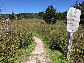
| Lewis Fork Wilderness | |
|---|---|
 Sign for the wilderness boundary along the Appalachian Trail | |
| Location | Grayson County, Smyth County Virginia, United States |
| Nearest city | Abingdon, Virginia |
| Coordinates | 36°39′35″N 81°32′41″W / 36.65972°N 81.54472°W |
| Area | 6,076 acres (2,459 ha) |
| Established | 1984 |
| Administrator | U.S. Forest Service |
The Lewis Fork Wilderness is an area in the Mount Rogers National Recreation Area protected by the Eastern Wilderness Act of Congress to maintain its present, natural condition. As part of the wilderness system, it is intended to preserve a variety of natural life forms and contribute to a diversity of plant and animal gene pools. Over half of the ecosystems in the United States exist within designated wilderness.[1]
The highlight of the wilderness is Mount Rogers, which at 5729 feet is the tallest mountain in Virginia and the highest point in the Appalachians between North Carolina and New Hampshire. With frequent cloud cover and moist moss draping from rocks and tree limbs, the wooded area at the top of the mountain creates a sense of awe in a silence so quiet that a finger snap can produce an echo.[2][3]
The area is part of the Mount Rogers Cluster.
- ^ Wilderness.org: Why Wilderness? | Wilderness.org, accessdate: June 10, 2017
- ^ Tennis, Joe (2004). Southwest Virginia Crossroads. Johnson City, Tennessee: Overmountain Press. p. 101. ISBN 1570722560.
- ^ Bamford, Sherman (October 2014). 18 Wonders of Virginia. Richmond, Virginia: Sierra Club Virginia Chapter. pp. 63–67. ISBN 978-0-926487-79-6.
© MMXXIII Rich X Search. We shall prevail. All rights reserved. Rich X Search

