| River Lymington or Lymington River Highland Water | |
|---|---|
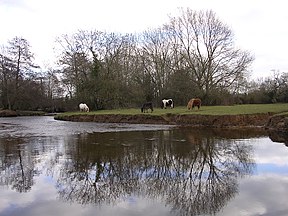
 New Forest ponies grazing next to the Lymington River near Brockenhurst | |
| Location | |
| Country | England |
| Region | Hampshire |
| District | New Forest |
| Physical characteristics | |
| Source | |
| • location | Ocknell Plain |
| • coordinates | 50°54′43″N 1°39′22″W / 50.912°N 1.656°W |
| • elevation | 105 metres (344 ft) |
| Mouth | |
• location | Lymington |
• coordinates | 50°45′00″N 1°31′59″W / 50.750°N 1.533°W |
• elevation | 0 metres |
| Length | 22 km (14 mi) |
| Basin features | |
| Tributaries | |
| • left | Long Brook, Bagshot Gutter, Etherise Gutter |
| • right | Warwickslade Cutting, Fletchers Water, Ober Water, Passford Water |

The Lymington River drains part of the New Forest in Hampshire in southern England. Numerous headwaters to the west of Lyndhurst give rise to the river, including Highland Water, Bratley Water and Fletchers Water. From Brockenhurst the river runs southwards to the Solent at Lymington.
Highland Water rises north of the Ocknell Inclosure (SU243125) and flows for 10 km (6 mi) to Bolderford Bridge (SU291041) where it meets Ober Water. From there, it is known as the Lymington River and flows for a further 12 km (7 mi) to (SZ3493).
© MMXXIII Rich X Search. We shall prevail. All rights reserved. Rich X Search

