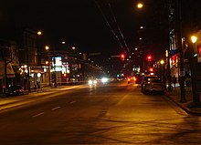
 Main Street at night near 26th Avenue, looking north | |
| Part of | Former Highway 1A / Highway 99A |
|---|---|
| Type | Street |
| Length | 8.8 km (5.5 mi)[1] |
| Location | Vancouver, British Columbia, Canada |
| North end | Waterfront Road |
| Major junctions |
|
| South end | Kent Avenue |


Main Street is a major north–south thoroughfare bisecting Vancouver, British Columbia, Canada. It runs from Waterfront Road by Burrard Inlet in the north, to Kent Avenue alongside the north arm of the Fraser River in the south.
- ^ Google (August 24, 2021). "Main Street (Vancouver)" (Map). Google Maps. Google. Retrieved August 24, 2021.
© MMXXIII Rich X Search. We shall prevail. All rights reserved. Rich X Search
