Back ماثراكى ARZ Матракі Byelorussian Матракі BE-X-OLD Nisí Mathráki CEB Mathraki German Μαθράκι Greek Mazraki Spanish Mathráki Finnish Mathraki French Mathraki Galician
Mathraki
Μαθράκι | |
|---|---|
| Coordinates: 39°46′N 19°31′E / 39.767°N 19.517°E | |
| Country | Greece |
| Administrative region | Ionian Islands |
| Regional unit | Corfu |
| Municipality | Central Corfu and Diapontian Islands |
| Area | |
| • Municipal unit | 3.532 km2 (1.364 sq mi) |
| Highest elevation | 152 m (499 ft) |
| Population (2021)[1] | |
| • Municipal unit | 174 |
| • Municipal unit density | 49/km2 (130/sq mi) |
| Time zone | UTC+2 (EET) |
| • Summer (DST) | UTC+3 (EEST) |
| Postal code | 491 00 |
| Area code(s) | 26630 |
| Vehicle registration | ΚΥ |
| Website | mathraki.net |
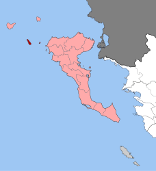
Mathraki (Greek: Μαθράκι, Ancient Greek: Μαθράκιον) is an island and a former community of the Ionian Islands, Greece. It is one of the Diapontian Islands. Since the 2019 local government reform, it is part of the municipality of Central Corfu and Diapontian Islands, of which it is a municipal unit.[2] The municipal unit has an area of 3.532 km2.[3] Mathraki is a 45-minute boat ride off the coast of Corfu (4 NM from Cape Arilas). It has three restaurants that double as general stores, villas and "rooms to let". Mathraki is a quiet island that manages to stay clear of tourists except for the occasional hikers that brave the rocky coastline. The municipal unit includes the three nearby islets Diakopo, Diaplo and Tracheia.
- ^ "Αποτελέσματα Απογραφής Πληθυσμού - Κατοικιών 2021, Μόνιμος Πληθυσμός κατά οικισμό" [Results of the 2021 Population - Housing Census, Permanent population by settlement] (in Greek). Hellenic Statistical Authority. 29 March 2024.
- ^ "Τροποποίηση του άρθρου 1 του ν. 3852/2010" [Amendment of Article 1 of l. 3852/2010] (in Greek). Government Gazette. p. 1164.
- ^ "Population & housing census 2001 (incl. area and average elevation)" (PDF) (in Greek). National Statistical Service of Greece. Archived from the original (PDF) on 2015-09-21.
© MMXXIII Rich X Search. We shall prevail. All rights reserved. Rich X Search

