Back ماولاميين Arabic ماولاميين ARZ Molamyayn Azerbaijani Малам’яйн Byelorussian ဝေင်ꩻမောႏလမျင်ႏ BLK মৌলামাইন Bengali/Bangla Mawlamyaing Catalan Моламьяйн CE Mawlamyine (kapital sa rehiyon sa Burma) CEB Mawlamyine Danish
Mawlamyine
မော်လမြိုင် မတ်မလီု | |
|---|---|
Capital Town | |
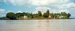
Top to bottom and left to right: Uzina Pagoda, Kyaikthanlan Pagoda, Pa-Auk Forest Monastery, Mahar Myat Muni Pagoda, Shri Shiva Lokanathan Temple, Cathedral of the Holy Family, Moghul Shiah Mosque, Mawlamyine University, Shampoo Island on the Salween | |
| Coordinates: 16°29′N 97°37′E / 16.483°N 97.617°E | |
| Country | |
| State | |
| District | Mawlamyine District |
| Township | Mawlamyine Township |
| Population (2014 Census)[1] | |
• Capital Town | 289,388 |
| • Urban | 253,734 |
| • Rural | 35,654 |
| • Ethnicities | Mons Burmans Chinese Indians Karens |
| • Religions | Theravada Buddhism Christianity Islam Hinduism |
| Demonym(s) | Moulmeinian, Mawlamyinian |
| Time zone | UTC+6.30 (MST) |
| Area code | 57 |
| [2] | |
Mawlamyine (also spelled Mawlamyaing; Burmese: မော်လမြိုင်မြို့; MLCTS: mau la. mruing mrui., Burmese pronunciation: [mɔ̀ləmjàɪ̯ɰ̃ mjo̰]; Thai: เมาะลำเลิง; Mon: မတ်မလီု, Mon pronunciation: [mo̤t məlɜ̤m]), formerly Moulmein, is the fourth-largest city in Myanmar (Burma),[3][4] 300 kilometres (190 mi) south east of Yangon and 70 kilometres (43 mi) south of Thaton, at the mouth of Thanlwin (Salween) River. Mawlamyine was an ancient city and the first capital of British Burma. The city is currently the capital and largest city of Mon State and the main trading centre and seaport in south eastern Myanmar.[5]
- ^ The 2014 Myanmar Population and Housing Census The Union Report Census Report Volume 2 (PDF). Department of Population, Ministry of Immigration and Population. May 2015. p. 59.
- ^ "National Telephone Area Codes". Myanmar Yellow Pages. Archived from the original on 2010-11-20.
- ^ "Myanmar: largest cities and towns and statistics of their population: calculation 2010". Archived from the original on 19 September 2012. World Gazetteer
- ^ "Population of Cities in Myanmar (2017)". worldpopulationreview.com. Retrieved 2017-10-22.
- ^ "Mawlamyine or Moulmein". allmyanmar.com. Retrieved 2009-02-03.
© MMXXIII Rich X Search. We shall prevail. All rights reserved. Rich X Search


