Back McLaren Vale CEB مک لارن ویل، استرالیای جنوبی Persian McLaren Vale Malagasy McLaren Vale Polish McLaren Vale Swedish
| McLaren Vale South Australia | |||||||||||||||
|---|---|---|---|---|---|---|---|---|---|---|---|---|---|---|---|
 | |||||||||||||||
| Coordinates | 35°13′11″S 138°32′28″E / 35.219773°S 138.541119°E[1] | ||||||||||||||
| Population | 3,277 (UCL 2021)[2] | ||||||||||||||
| Established | 1838[citation needed] 13 July 1995 (locality)[3] | ||||||||||||||
| Postcode(s) | 5171[4] | ||||||||||||||
| Area | 3.9 km2 (1.5 sq mi)[citation needed] | ||||||||||||||
| Time zone | ACST (UTC+9:30) | ||||||||||||||
| • Summer (DST) | ACST (UTC+10:30) | ||||||||||||||
| Location |
| ||||||||||||||
| LGA(s) | City of Onkaparinga[1] | ||||||||||||||
| Region | Southern Adelaide[5] | ||||||||||||||
| County | Adelaide[1] | ||||||||||||||
| State electorate(s) | Mawson[6] | ||||||||||||||
| Federal division(s) | Mayo[7] | ||||||||||||||
| |||||||||||||||
| |||||||||||||||
| Footnotes | Locations[4][1] Adjoining localities[1] | ||||||||||||||
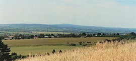
McLaren Vale is a town and locality in the Australian state of South Australia located about 33 kilometres (21 mi) south of the Adelaide city centre and about 9 kilometres (5.6 mi) south of the municipal seat at Noarlunga Centre.[4][1]
- ^ a b c d e f "Search results for 'McLaren Vale, LOCB' with the following datasets being selected – 'Suburbs and Localities', 'Counties', 'Government Towns', 'Hundreds', 'Local Government Areas', 'SA Government Regions', 'Gazetteer' and 'Roads'". Location SA Map Viewer. Government of South Australia. Retrieved 16 June 2018.
- ^ Australian Bureau of Statistics (28 June 2022). "McLaren Vale (urban centre and locality)". Australian Census 2021.
- ^ Wotton, David (13 July 1995). "GEOGRAPHICAL NAMES ACT, 1991 Notice to Assign" (PDF). The. Government of South Australia. p. 61. Retrieved 2 February 2019.
- ^ a b c "Postcode for McLaren Vale, South Australia". Postcodes Australia. Retrieved 2 February 2019.
- ^ "Southern Adelaide SA Government region" (PDF). The Government of South Australia. Retrieved 17 April 2017.
- ^ Mawson 2018-2022 electoral district map (Map). Electoral District Boundaries Commission. 2016. Retrieved 7 August 2019.
- ^ "Federal electoral division of Mayo". Australian Electoral Commission. Retrieved 16 June 2018.
- ^ a b c "Monthly climate statistics: Summary statistics NOARLUNGA (nearest weather station)". Commonwealth of Australia, Bureau of Meteorology. Retrieved 2 February 2019.
© MMXXIII Rich X Search. We shall prevail. All rights reserved. Rich X Search
