Back مقاطعة ميامي (إنديانا) Arabic Miami County, Indiana BAR Маями (окръг, Индиана) Bulgarian মায়ামি কাউন্টি, ইন্ডিয়ানা BPY Miami Gông (Indiana) CDO Майами (гуо, Индиана) CE Miami County (kondado sa Tinipong Bansa, Indiana) CEB Miami County, Indiana Welsh Miami County (Indiana) German Κομητεία Μαϊάμι (Ιντιάνα) Greek
Miami County | |
|---|---|
 Miami County Courthouse in Peru, Indiana | |
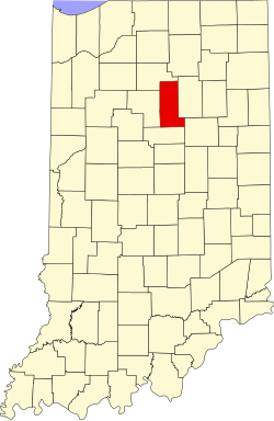
 Location within the U.S. state of Indiana | |
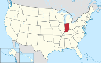
 Indiana's location within the U.S. | |
| Coordinates: 40°46′N 86°03′W / 40.77°N 86.05°W | |
| Country | |
| State | |
| Founded | January 30, 1833 |
| Named after | Miami tribe |
| Seat | Peru |
| Largest city | Peru |
| Area | |
• Total | 377.39 sq mi (977.4 km2) |
| • Land | 373.84 sq mi (968.2 km2) |
| • Water | 3.55 sq mi (9.2 km2) 0.94% |
| Population (2020) | |
• Total | 35,962 |
• Estimate (2023) | 35,402 |
| • Density | 95/sq mi (37/km2) |
| Time zone | UTC−5 (Eastern) |
| • Summer (DST) | UTC−4 (EDT) |
| Congressional district | 2nd |
| Website | www |
| Indiana county number 52 | |
Miami County is a county located in the U.S. state of Indiana. As of 2020, the population was 35,962.[1] The county seat is the City of Peru.[2] Miami County is part of the Kokomo-Peru CSA.
- ^ "Miami County QuickFacts". United States Census Bureau. Retrieved January 23, 2023.
- ^ "Find a County". National Association of Counties. Retrieved June 7, 2011.
© MMXXIII Rich X Search. We shall prevail. All rights reserved. Rich X Search