Back مويرس (نيويورك) Arabic موئرز ، نیویورک AZB Mooers Catalan Mooers (CDP, New York) German Mooers (condado de Clinton) Spanish موئرز (حوزه سرشماری)، نیویورک Persian Mooers (CDP, New York) French Mooers (CDP), New York Malagasy Mooers (hrabstwo Clinton) Polish Муерс (сан алу урыны, Нью-Йорк) Tatar
Mooers, New York | |
|---|---|
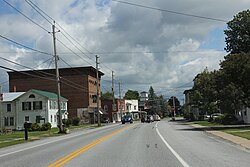
 Downtown Mooers on US Route 11 | |
 Location in Clinton County and the state of New York. | |
| Coordinates: 44°57′40″N 73°35′10″W / 44.96111°N 73.58611°W | |
| Country | United States |
| State | New York |
| County | Clinton |
| Town | Mooers |
| Incorporated | September 1899[1] |
| Dissolved | March 31, 1994[2] |
| Area | |
| • Total | 1.25 sq mi (3.25 km2) |
| • Land | 1.21 sq mi (3.14 km2) |
| • Water | 0.04 sq mi (0.11 km2) |
| Elevation | 282 ft (86 m) |
| Population (2020) | |
| • Total | 451 |
| • Density | 371.50/sq mi (143.48/km2) |
| Time zone | UTC-5 (Eastern (EST)) |
| • Summer (DST) | UTC-4 (EDT) |
| ZIP code | 12958 |
| Area code | 518 |
| FIPS code | 36-48241 |
| GNIS feature ID | 2389503 |
Mooers, formerly Mooers-upon-the-Chazy, is a hamlet and census-designated place in the town of Mooers, in Clinton County, New York, United States. The population was 442 at the 2010 census,[4] out of a total population of 3,592 in the town. It was once an incorporated village, but dissolved in 1994.
Mooers is in northern New York state, near the Canada–United States border with the Canadian province of Quebec.
- ^ The Press-Republican (Rouses Point, NY), Village Incorporated in 1899, December 8, 1983, page 21, Retrieved Jun. 12, 2015.
- ^ New York State Division of Local Government Services - Villages dissolved since 1900 & incorporated since 1940, Retrieved Jun. 12, 2015.
- ^ "ArcGIS REST Services Directory". United States Census Bureau. Retrieved September 20, 2022.
- ^ "Geographic Identifiers: 2010 Demographic Profile Data (G001): Mooers CDP, New York". U.S. Census Bureau, American Factfinder. Archived from the original on February 12, 2020. Retrieved December 5, 2014.
© MMXXIII Rich X Search. We shall prevail. All rights reserved. Rich X Search