Back جبل مونت كاتاهدين ARZ Mont Katahdin Catalan Mount Katahdin CEB Mount Katahdin Czech Katahdin Danish Mount Katahdin German Monte Katahdin Spanish کوه کتاهدین Persian Mont Katahdin French הר קטדין HE
| Mount Katahdin | |
|---|---|
 Katahdin from 10,000 ft (3,000 m) | |
| Highest point | |
| Elevation | 5,270 ft (1,610 m) NAVD 88[1] |
| Prominence | 4,288 ft (1,307 m)[2] |
| Listing | |
| Coordinates | 45°54′16″N 68°55′17″W / 45.904354472°N 68.921274306°W[1] |
| Geography | |
| Location | |
| Parent range | Appalachian Mountains |
| Topo map | USGS Mount Katahdin |
| Geology | |
| Age of rock | Devonian, Acadian orogeny |
| Mountain type | Granite |
| Climbing | |
| Easiest route | Hike, Abol Trail / Hunt Trail 3.8 miles (6.1 km) |
| Designated | 1967 |
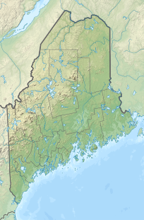
Mount Katahdin (/kəˈtɑːdɪn/ kə-TAH-din) is the highest mountain in the U.S. state of Maine at 5,269 feet (1,606 m). Named Katahdin, which means "Great Mountain",[3] by the Penobscot Native Americans, it is within Northeast Piscataquis, Piscataquis County, and is the centerpiece of Baxter State Park. It is a steep, tall massif formed from a granite intrusion weathered to the surface. The flora and fauna on the mountain are typical of those found in northern New England, with the summit hosting fragile and endangered alpine tundra.
Katahdin was known to the Native Americans in the region and was known to Europeans at least since 1689. It has inspired hikes, climbs, journal narratives, paintings, and a piano sonata.[4] The area around the peak was protected by Governor Percival Baxter starting in the 1930s. Katahdin is the northern terminus of the Appalachian Trail and is near a stretch known as the Hundred-Mile Wilderness. Though part of the Appalachian Mountain system, Katahdin is isolated from the range, and sits largely on its own as a monadnock. The nearest higher mountains in any direction are the high peaks of the Presidential Range, around 170 miles to the south-west.
In 1967, Mount Katahdin was designated as a National Natural Landmark by the National Park Service.[5]
The mountain is commonly called just "Katahdin",[6] though the official name is "Mount Katahdin" as decided by the US Board on Geographic Names in 1893.[7]
- ^ a b "Mount Katahdin 2". NGS Data Sheet. National Geodetic Survey, National Oceanic and Atmospheric Administration, United States Department of Commerce. Retrieved January 13, 2024.
- ^ "Katahdin, Maine". Peakbagger.com. Retrieved 2012-11-08.
- ^ Gannett, Henry (1905). The Origin of Certain Place Names in the United States. Govt. Print. Off. pp. 172.
- ^ "Hovhaness: Khaldis; Mount Katahdin; Fantasy, Op. 16". Classical-music.com. Retrieved 2012-11-08.
- ^ "National Natural Landmarks - National Natural Landmarks (U.S. National Park Service)". www.nps.gov. Retrieved 2019-03-22.
Year designated: 1967
- ^ Clark, Stephen (2003). Katahdin: A Guide to Baxter State Park & Katahdin. Clark Books. ISBN 0-9741677-6-2.
- ^ "GNIS Detail - Mount Katahdin". geonames.usgs.gov. Retrieved 13 August 2017.
© MMXXIII Rich X Search. We shall prevail. All rights reserved. Rich X Search

