Munsee-Delaware Nation
Nalahii Lunaapewaak | |
|---|---|
| Munsee-Delaware Nation Indian Reserve No. 1 | |
| Coordinates: 42°48′N 81°29′W / 42.800°N 81.483°W | |
| Country | |
| Province | |
| County | Middlesex |
| First Nation | Munsee-Delaware |
| Formed | 1967 |
| Government | |
| • Chief | Roger Thomas |
| • Federal riding | Lambton—Kent—Middlesex |
| • Prov. riding | Lambton—Kent—Middlesex |
| Area | |
| • Land | 11.22 km2 (4.33 sq mi) |
| Population (2011)[1] | |
| • Total | 160 |
| • Density | 14.3/km2 (37/sq mi) |
| Time zone | UTC-5 (EST) |
| • Summer (DST) | UTC-4 (EDT) |
| Postal Code | N0L |
| Area code(s) | 519 and 226 |
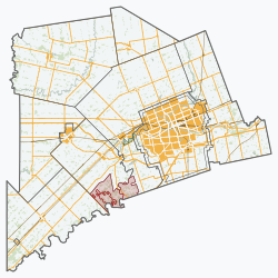
Munsee-Delaware Nation (Munsee: Nalahii Lunaapewaak, meaning: Lenapes from the Upstream, in contrast with The Lenape at Moraviantown, referred to as "Downstrean Lenapes") is a Lenape First Nations band government located 24 kilometres (15 mi) west of St. Thomas, in southwest Ontario, Canada.
Known previously as the Munsee of the Thames, their land base is the 1,054 hectares (2,600 acres) Munsee-Delaware Nation 1 reserve, with the unincorporated community of Muncey, west from the Oneida Nation of the Thames, as their main community. The reserve is splintered into several non-contiguous areas, made up of individual lots within the Chippewas of the Thames reserve. As of January 2014, their registered population was 612 people, though only 148 lived on their own reserve.
- ^ a b "Munsee-Delaware Nation 1 community profile". 2011 Census data. Statistics Canada. Retrieved 3 June 2015.
© MMXXIII Rich X Search. We shall prevail. All rights reserved. Rich X Search


