Back Vall de Nagar Catalan دره نگر Persian नगर वादी Hindi Valle di Nagar Italian ਨਗਰ ਵਾਦੀ Punjabi وادی نگر PNB Valea Nagar Romanian Nagar Valley SIMPLE நாகர் பள்ளத்தாக்கு Tamil وادی نگر Urdu
This article needs additional citations for verification. (December 2018) |
Nagar Valley | |
|---|---|
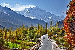
 The 7,788 m (25,551 ft) tall Rakaposhi as seen from the Hunza Valley | |
| Coordinates: 36°15′55″N 74°42′49″E / 36.2652548°N 74.7135025°E[1] | |
| Country | Pakistan |
| Region | Gilgit Baltistan |
| District | Nagar District |

Nagar Valley[2] once a princely state, now stands as one of the ten districts within the Gilgit-Baltistan region of Pakistan.[3][4][5] This valley is situated along the renowned Karakoram Highway, as one travels northward from the city of Gilgit. The valley is home to many high mountain peaks including Rakaposhi (7788m), Diran Peak (7265m), Golden Peak and Rush Peak.
The Nagar valley is administratively divided into two tehsils: Nagar-I and Nagar-II.[6] All the villages of upper Nagar including Shayar, Askurdas, Sumayar, Nagarkhas, Hoper Valley, and Hispar come under Nagar-I, whereas the villages of lower Nagar including Chalt Paeen, Chalt Bala, Sonikot, Akbarabad, Rabat, Bar, Buddalas, Chaprote, Sikandarabad, Jafarabad, Nilt, Thol, Ghulmet, Pisan, Minapin, Meacher, Dadhimal, Phekar, and Hakuchar are part of Nagar-II. Burushaski and Shina languages are predominantly spoken in the valley.[3]
The Rush Lake, the highest alpine lake of Pakistan and the 27th highest in the world, also lies in this valley.[7]
- ^ "Nagar on map". Google Maps. Retrieved 15 September 2019.
- ^ Martin, Sokefeld (2005). "From Colonialism to Postcolonial Colonialism: Changing Modes of Domination in the Northern Areas of Pakistan". The Journal of Asian Studies. 64 (4): 939–973. doi:10.1017/S0021911805002287. JSTOR 25075905. S2CID 161647755.
- ^ a b "Nagar Valley". visitgilgitbaltistan.gov.pk. Retrieved 15 September 2019.
- ^ "Dividing governance: Three new districts notified in G-B". The Express Tribune. 25 July 2015. Retrieved 17 February 2023.
- ^ "Nagar Valley, Gilgit Baltistan, Pakistan". myadventure.pk. Retrieved 7 November 2018.
- ^ "Geography & Demography of Gilgit-Baltistan". Gilgit-Baltistan Scouts. Retrieved 21 April 2022.
- ^ "27th highest peak".
© MMXXIII Rich X Search. We shall prevail. All rights reserved. Rich X Search
