| Nahant Beach Reservation | |
|---|---|
 Long Beach | |
| Location | Nahant, Essex, Massachusetts, United States |
| Coordinates | 42°26′50″N 70°56′12″W / 42.44722°N 70.93667°W[1] |
| Area | 67 acres (27 ha)[2] |
| Elevation | 0 ft (0 m)[1] |
| Established | ca. 1900 |
| Operator | Massachusetts Department of Conservation and Recreation |
| Website | Lynn Shore & Nahant Beach Reservation |
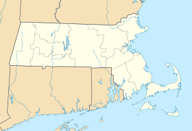
Nahant Beach Reservation is a protected coastal reservation covering 67 acres (27 ha) of beach and recreational areas in the town of Nahant, Massachusetts. Nahant Road, formerly known as Nahant Beach Boulevard when it was added to the National Register of Historic Places in 2003, offers access to 7,000-foot-long (2,100 m) Long Beach on the Atlantic Ocean side to the east. The reservation includes a boat ramp with access to Lynn Harbor and shares athletic fields with Lynn Shore Reservation in the area around Nahant Rotary, a traffic circle at the reservation's northern end.[3][4] The reservation is part of the Metropolitan Park System of Greater Boston.
- ^ a b "Long Beach". Geographic Names Information System. United States Geological Survey, United States Department of the Interior.
- ^ Cite error: The named reference
2012acreagelistwas invoked but never defined (see the help page). - ^ Cite error: The named reference
dcrwas invoked but never defined (see the help page). - ^ Cite error: The named reference
mapwas invoked but never defined (see the help page).
© MMXXIII Rich X Search. We shall prevail. All rights reserved. Rich X Search


