Back নঞ্জনগুড় Bengali/Bangla ননঞ্জনগুদ BPY Nanjangūd CEB Nanjangud Spanish نانجنگود Persian नंजनगुड़ Hindi Nanjangud Italian ನಂಜನಗೂಡು Kannada Nanjangud Malagasy Nanjangud Malay
This article needs additional citations for verification. (April 2021) |
Nanjangud
Nanjanagoodu | |
|---|---|
town | |
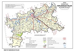
 Nanjangud Taluk Map | |
| Nickname(s): Paddy Land, Dakshina Kaashi | |
| Coordinates: 12°07′N 76°41′E / 12.12°N 76.68°E | |
| Country | |
| State | Karnataka |
| District | Mysore |
| Elevation | 656 m (2,152 ft) |
| Population (2011)[1] | |
| • Total | 61,961 |
| Time zone | UTC+5:30 (IST) |
| PIN | 571 301 |
| Telephone code | 08221 |
| Vehicle registration | KA-09 |
| Website | www.nanjanagudutown.gov.in; http://www.nanjanaguducity.mrc.gov.in |
Nanjangud, officially known as Nanjanagudu, is a town in the Mysuru district of the Indian state of Karnataka. Nanjangud lies on the banks of the river Kapila (also called Kabini), 23 km from the city of Mysore. Nanjangud is famous for the Srikanteshwara Temple located here. Nanjangud is also called Dakshina Kashi (southern Kashi).[2] This town is also famous for a type of banana grown in the region called the Nanjanagoodu rasabale.[3] Nanjangud's local administrative unit was designated as a Municipal Committee in 2015 by including Devirammanahalli and Kallahalli village.[4]
- ^ "Census of India Search details". censusindia.gov.in. Retrieved 10 May 2015.
- ^ "Nanjangud Town Municipal Council, Karnataka". Nanjangud Town Municipal Council. Archived from the original on 2 August 2013. Retrieved 25 July 2013.
- ^ "Nanjangud". Retrieved 28 August 2012.
- ^ "Gazette Notification" (PDF).
© MMXXIII Rich X Search. We shall prevail. All rights reserved. Rich X Search