Back नेशनल हाइवे 1 Bihari জাতীয় সড়ক ১ (ভারত) Bengali/Bangla Route nationale 1 (Inde) French राष्ट्रीय राजमार्ग १ (भारत) Hindi राष्ट्रीय महामार्ग १ Marathi தேசிய நெடுஞ்சாலை 1 Tamil జాతీయ రహదారి 1 Tegulu Національне шосе 1 (Індія) Ukrainian Quốc lộ 1 (Ấn Độ) Vietnamese
| National Highway 1 | ||||
|---|---|---|---|---|
 NH 1 through the Himalayan mountains | ||||
| Route information | ||||
| Maintained by BRO | ||||
| Length | 534 km (332 mi) | |||
| Major junctions | ||||
| East end | ||||
| West end | S-3 Strategic Highway, Hattian Bala | |||
| Location | ||||
| Country | India | |||
| States | Jammu & Kashmir, Ladakh | |||
| Primary destinations | Baramulla, Srinagar, Kargil | |||
| Highway system | ||||
| ||||

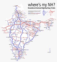
National Highway 1 (NH 1) in India runs between the union territories of Jammu & Kashmir and Ladakh. It comprises parts of old NH1A and NH1D.[1][2] The number 1 indicates, under the new numbering system,[2] that it is the northernmost East-West highway in India.
- ^ "New National Highways notification - GOI" (PDF). The Gazette of India. Retrieved 10 June 2018.
- ^ a b "Rationalisation of Numbering Systems of National Highways" (PDF). New Delhi: Department of Road Transport and Highways. Archived from the original (PDF) on 1 February 2016. Retrieved 3 April 2012.
© MMXXIII Rich X Search. We shall prevail. All rights reserved. Rich X Search
