Back Naval Air Station Patuxent River CEB Naval Air Station Patuxent River German Estación aeronaval del Río Patuxent Spanish پایگاه هوایی رودخانه پاتوکسنت Persian Naval Air Station Patuxent River French パタクセント・リバー海軍航空基地 Japanese Naval Air Station Patuxent River Dutch Naval Air Station Patuxent River Polish Naval Air Station Patuxent River Swedish Пойгоҳи ҳавоии Дарёи Патуксент Tajik
| Naval Air Station Patuxent River | |||||||||||
|---|---|---|---|---|---|---|---|---|---|---|---|
Trapnell Field | |||||||||||
| St. Mary’s County, Maryland in the United States | |||||||||||
 | |||||||||||
 | |||||||||||
| Coordinates | 38°17′10″N 76°24′42″W / 38.28611°N 76.41167°W | ||||||||||
| Type | Naval Air Station | ||||||||||
| Site information | |||||||||||
| Owner | Department of Defense | ||||||||||
| Operator | US Navy | ||||||||||
| Controlled by | Naval District Washington | ||||||||||
| Condition | Operational | ||||||||||
| Website | Official website | ||||||||||
| Site history | |||||||||||
| Built | 1942 – 1943 | ||||||||||
| In use | 1943 – present | ||||||||||
| Garrison information | |||||||||||
| Current commander | Captain John Brabazon | ||||||||||
| Garrison | Naval Test Wing Atlantic | ||||||||||
| Airfield information | |||||||||||
| Identifiers | IATA: NHK, ICAO: KNHK, FAA LID: NHK, WMO: 72404[citation needed] | ||||||||||
| Elevation | 11.8 metres (39 ft) AMSL | ||||||||||
| |||||||||||
| Source: Federal Aviation Administration[1] | |||||||||||
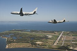
Naval Air Station Patuxent River (IATA: NHK, ICAO: KNHK, FAA LID: NHK), also known as NAS Pax River, is a United States naval air station located in St. Mary’s County, Maryland, on the Chesapeake Bay near the mouth of the Patuxent River.
It is home to Headquarters, Naval Air Systems Command (NAVAIR), the U.S. Naval Test Pilot School, the Atlantic Test Range, Patuxent River Naval Air Museum, and serves as a center for test and evaluation and systems acquisition relating to naval aviation. The station also operates a small outlying field, NOLF Webster.
Commissioned on April 1, 1943, on land largely acquired through eminent domain, the air station grew rapidly in response to World War II and continued to evolve through the Cold War to the present.
© MMXXIII Rich X Search. We shall prevail. All rights reserved. Rich X Search

