Back Netaji Subhas Chandra Bose Internasionale Lughawe Afrikaans مطار نيتاجي سوبهاس شاندرا بوس الدولي Arabic নেতাজি সুভাষচন্দ্র বসু আন্তর্জাতিক বিমানবন্দর Bengali/Bangla Netaji Subhas Chandra Bose International Airport CEB Mezinárodní letiště Subháse Čandry Boseho Czech Flughafen Kolkata German Aeropuerto Internacional Netaji Subhas Chandra Bose Spanish Netaji Subhas Chandra Bose rahvusvaheline lennujaam Estonian فرودگاه بینالمللی نتاجی سبهاش چندر بوس Persian Netaji Subhas Chandra Bosen kansainvälinen lentoasema Finnish
Netaji Subhas Chandra Bose International Airport | |||||||||||||||
|---|---|---|---|---|---|---|---|---|---|---|---|---|---|---|---|
 | |||||||||||||||
| Summary | |||||||||||||||
| Airport type | Public | ||||||||||||||
| Owner/Operator | Airports Authority of India | ||||||||||||||
| Serves | Kolkata Metropolitan Area | ||||||||||||||
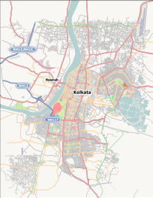
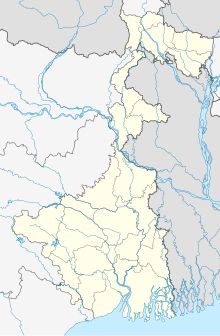
| Location | Kolkata, West Bengal, India | ||||||||||||||
| Opened | 1924 | ||||||||||||||
| Hub for | |||||||||||||||
| Focus city for | |||||||||||||||
| Built | Early 1900s as the Calcutta Aerodrome | ||||||||||||||
| Elevation AMSL | 5 m / 16 ft | ||||||||||||||
| Coordinates | 22°39′17″N 088°26′48″E / 22.65472°N 88.44667°E | ||||||||||||||
| Website | Kolkata Airport | ||||||||||||||
| Map | |||||||||||||||
| Runways | |||||||||||||||
| |||||||||||||||
| Statistics (April 2023 - March 2024) | |||||||||||||||
| |||||||||||||||
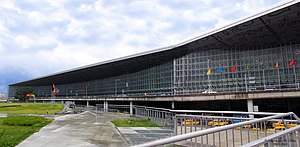
Netaji Subhash Chandra Bose International Airport (IATA: CCU, ICAO: VECC) is an international airport serving Kolkata and the Kolkata Metropolitan Region. It is the primary aviation hub for eastern and northeastern India. It is located approximately 15 kilometres (9.3 mi) from the city centre. The airport is locally known as Kolkata Airport and Dum Dum Airport before being renamed in 1995 after Subhas Chandra Bose, one of the most prominent leaders of the Indian independence movement, from Bengal. The airport's IATA code CCU is associated with "Calcutta", the former legal name of the city. Opened in 1924, Kolkata Airport is one of the oldest airports in India.
Spread over an area of 6.64 square kilometres (2.56 sq mi), Kolkata Airport is the largest hub for air traffic in the eastern part of the country and one of two international airports operating in West Bengal, the other being Bagdogra in Siliguri. The airport handled around 20 million passengers in the financial year 2023–24, making it the sixth-busiest airport in India in terms of passenger traffic, after Delhi, Mumbai, Bangalore, Hyderabad and Chennai airports.[1] The airport is a major centre for flights to Northeast India, Bangladesh, Bhutan, Southeast Asia and the Middle Eastern cities of Dubai, Doha and Abu Dhabi. It is situated across Jessore Road in Dum Dum Region.
- ^ a b "Annexure III – Passenger Data" (PDF). aai.aero. Retrieved 19 April 2024.
- ^ "Annexure II – Aircraft Movement Data" (PDF). aai.aero. Retrieved 19 April 2024.
- ^ "Annexure IV – Freight Movement Data" (PDF). aai.aero. Retrieved 19 April 2024.
© MMXXIII Rich X Search. We shall prevail. All rights reserved. Rich X Search


