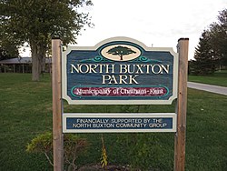
North Buxton | |
|---|---|
dispersed rural community | |
 | |
| Coordinates: 42°18′37″N 82°13′30″W / 42.3103°N 82.225°W[1] | |
| Country | Canada |
| Province | Ontario |
| Region | Southwestern Ontario |
| Municipality | Chatham-Kent |
| Established | 1849 |
| Time zone | UTC-5 (EST) |
| • Summer (DST) | UTC-4 (EDT) |
| Postal Code | N0P 1Y0 |
| Area codes | 519, 226, 548 |
North Buxton is a dispersed rural community located in Southwestern Ontario, Canada.[1][2][3][4][5] It was established in 1849 as a community for and by former African-American slaves who escaped to Canada to gain freedom. Rev. William King, a Scots-Irish/American Presbyterian minister and abolitionist, had organized the Elgin Association to buy 9,000 acres of land for resettlement of the refugees, to give them a start in Canada. Within a few years, numerous families were living here, having cleared land, built houses, and developed crops. They established schools and churches, and were thriving before the American Civil War.
There was great interest in the settlement among Americans. Buxton was visited by a reporter from the New York Herald Tribune in 1857, and by the head of the American Freedmen's Inquiry Commission in the summer of 1863, established after President Abraham Lincoln's Emancipation Proclamation had freed many slaves in the American South during the Civil War. The resultant reports praised the achievements of the people of Buxton and other African Americans in Canada.
The community is within the Chatham-Kent municipality, at the junction of Chatham-Kent Roads 6 and 14.[3][5] Its population in the early 21st century is approximately 250, over half of whom are Black Canadians. North Buxton's historic population peaked at more than 2000, almost exclusively descendants of free blacks and fugitive slaves who had escaped the United States via the Underground Railroad. Upper Canada (now known as the province of Ontario, after the Dominion of Canada was confederated in 1867) was the first British colony to abolish slavery, in 1793. Though slavery had never been widespread in Canada, Great Britain abolished slavery in its colonies in 1838. The related community is South Buxton.
- ^ a b "North Buxton". Geographical Names Data Base. Natural Resources Canada. Retrieved 2020-10-09.
- ^ "Toporama (on-line map and search)". Atlas of Canada. Natural Resources Canada. 12 September 2016. Retrieved 2020-10-09.
- ^ a b "Ontario Geonames GIS (on-line map and search)". Ontario Ministry of Natural Resources and Forestry. 2014. Retrieved 2020-10-09.
- ^ Restructured municipalities - Ontario map #6 (Map). Restructuring Maps of Ontario. Ontario Ministry of Municipal Affairs and Housing. 2006. Archived from the original on 2021-02-24. Retrieved 2020-10-09.
- ^ a b Map 1 (PDF) (Map). 1 : 700,000. Official road map of Ontario. Ministry of Transportation of Ontario. 2018-01-01. Retrieved 2020-10-09.
© MMXXIII Rich X Search. We shall prevail. All rights reserved. Rich X Search


