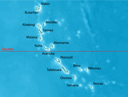
 Map of North Tarawa | |
 | |
| Geography | |
|---|---|
| Location | Pacific Ocean |
| Coordinates | 1°26′N 173°00′E / 1.433°N 173.000°E |
| Archipelago | Gilbert Islands |
| Area | 15.26 km2 (5.89 sq mi) |
| Highest elevation | 3 m (10 ft) |
| Administration | |
| Demographics | |
| Population | 7,041 (2020 Census[1]) |
| Pop. density | 400/km2 (1000/sq mi) |
| Ethnic groups | I-Kiribati 99.7% |
| Official name | Nooto-North Tarawa |
| Designated | 4 March 2013 |
| Reference no. | 2143[2] |
North Tarawa or in Gilbertese Tarawa Ieta, in the Republic of Kiribati, is the string of islets from Buariki at the northern tip of Tarawa atoll to Buota in the South, with a combined population of 6,629 as of 2015[update]. It is administratively separate from neighbouring South Tarawa, and is governed by the Eutan Tarawa Council (ETC), based at Abaokoro.
- ^ 2020 Kiribati Population and Housing Census
- ^ "Nooto-North Tarawa". Ramsar Sites Information Service. Retrieved 25 April 2018.
© MMXXIII Rich X Search. We shall prevail. All rights reserved. Rich X Search


