Back نهر نيوسيس Arabic نهر نويسيس ARZ Nueces River BAR Нюейсъс Bulgarian Riu Nueces Catalan Nueces River CEB Nueces Czech Нуэсес (юханшыв) CV Nueces River Danish Nueces River German
| Nueces River Río de las Nueces | |
|---|---|
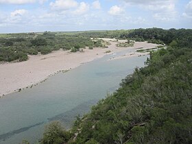
 U.S. Highway 83 crosses the Nueces River in northern Zavala County between La Pryor and Uvalde, Texas. | |
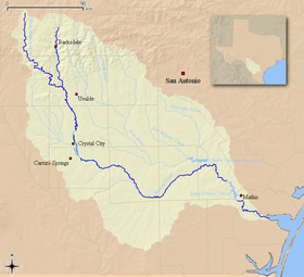
 Nueces River watershed | |
| Native name | Chotilapacquen (Coahuilteco) |
| Location | |
| Country | United States |
| State | Texas |
| Physical characteristics | |
| Source | Edwards Plateau |
| Source confluence | Hackberry Hollow, Edwards County, Texas |
| Mouth | Corpus Christi Bay |
• location | Nueces County, Texas |
• coordinates | 27°50′16″N 97°29′22″W / 27.83778°N 97.48944°W |
| Length | 315 mi (507 km) |
| Discharge | |
| • location | Northwest Corpus Christi, TX |

The Nueces River (/njuˈeɪsɪs/ new-AY-siss; Spanish: Río Nueces, IPA: [ˈri.o ˈnweses]) is a river in the U.S. state of Texas, about 315 miles (507 km) long.[1] It drains a region in central and southern Texas southeastward into the Gulf of Mexico. It is the southernmost major river in Texas northeast of the Rio Grande. Nueces is Spanish for nuts, specifically pecans;[2] early settlers named the river after the numerous pecan trees along its banks.
© MMXXIII Rich X Search. We shall prevail. All rights reserved. Rich X Search