Back نهر اوسويجو ARZ Oswego River (suba sa Tinipong Bansa, New York) CEB Oswego River (Ontariosee) German Oswego (rivière) French オスウェゴ川 (ニューヨーク州) Japanese Oswego (rzeka w stanie Nowy Jork) Polish Oswego (flod) Swedish
| Oswego River | |
|---|---|
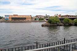
 The Oswego River as it passes through the city of Oswego. | |
 The Oswego drainage basin, with the Oswego River highlighted | |
| Location | |
| Country | United States |
| State | New York |
| Counties | Onondaga, Oswego |
| City | Oswego |
| Physical characteristics | |
| Source | Seneca River |
| • location | Geneva |
| • coordinates | 42°52′05″N 76°56′27″W / 42.86806°N 76.94083°W[1] |
| • elevation | 443 ft (135 m)[2] |
| 2nd source | Oneida River |
| • location | Brewerton |
| • coordinates | 43°14′24″N 76°08′26″W / 43.24000°N 76.14056°W[3] |
| Source confluence | |
| • location | Northwest of Syracuse |
| • coordinates | 43°12′5″N 76°16′50″W / 43.20139°N 76.28056°W[4] |
| • elevation | 357 ft (109 m)[4] |
| Mouth | Lake Ontario |
• location | Oswego |
• coordinates | 43°27′54″N 76°30′50″W / 43.46500°N 76.51389°W[4] |
• elevation | 245 ft (75 m)[5] |
| Basin size | 5,122 sq mi (13,270 km2) |
| Discharge | |
| • location | Oswego[6] |
| • average | 6,912 cu ft/s (195.7 m3/s)[6] |
| • minimum | 261 cu ft/s (7.4 m3/s)(September 18, 1985)[6] |
| • maximum | 37,000 cu ft/s (1,000 m3/s)(March 28, 1936)[6] |
The Oswego River (/ɒsˈwiːɡoʊ/) is a river in upstate New York in the United States. It is the second-largest river (after the Niagara River) flowing into Lake Ontario. James Fenimore Cooper’s novel The Pathfinder, or The Inland Sea is set in the Oswego River valley.[7]
The name Oswego is a Mohawk name that means "flowing out", or specifically, "small water flowing into that which is large".[8]
- ^ "Seneca River". Geographic Names Information System. United States Geological Survey, United States Department of the Interior. 1980-01-23. Retrieved 2014-09-05.
- ^ "Seneca Lake". Geographic Names Information System. United States Geological Survey, United States Department of the Interior. 1980-01-23. Retrieved 2014-09-05.
- ^ "Oneida River". Geographic Names Information System. United States Geological Survey, United States Department of the Interior. Retrieved December 30, 2015.
- ^ a b c "Oswego River". Geographic Names Information System. United States Geological Survey, United States Department of the Interior. Retrieved December 29, 2015.
- ^ Google Earth elevation for GNIS coordinates.
- ^ a b c d "04249000 Oswego River at Lock 7, Oswego NY, Water Data Report 2013" (PDF). National Water Information System. United States Geological Survey. 1934–2013. Retrieved December 30, 2015.
- ^ "Oswego." The Columbia Gazetteer of the World Online. New York: Columbia University Press, 2005. http://www.columbiagazetteer.org/ . Accessed: February 14, 2008
- ^ Beauchamp, William Martin (1907). Aboriginal Place Names of New York (New York State Museum Bulletin, Volume 108). New York State Education Department. p. 171. ISBN 9781404751552. Retrieved December 30, 2015.
© MMXXIII Rich X Search. We shall prevail. All rights reserved. Rich X Search