Back باشيم مدينبور Arabic باشيم مدينبور ARZ पश्चिम मेदिनीपुर जिला Bihari পশ্চিম মেদিনীপুর জেলা Bengali/Bangla Paschim Medinipur CEB Paschim Medinipur German Distrito de Midnapore occidental Spanish Paschim Medinipur barrutia Basque بخش پاسچیم مدینی پور Persian District de Paschim Medinipur French
This article has multiple issues. Please help improve it or discuss these issues on the talk page. (Learn how and when to remove these template messages)
|
Paschim Medinipur | |
|---|---|
|
Clockwise from top-left: Nabaratna Temple in Pathra, Takshashila building at IIT Kharagpur, Kurumbera Fort, Vidyasagar University in Midnapore, Gongoni Danga, Kangsabati River | |
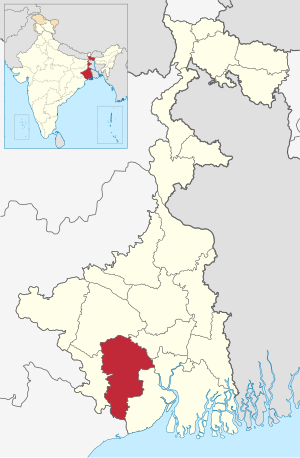
 Location of Paschim Medinipur in West Bengal | |
| Country | |
| State | |
| Division | Midnapore |
| Headquarters | Midnapore |
| Government | |
| • Lok Sabha constituencies | Medinipur, Ghatal, Jhargram (ST) – all have assembly segments in adjoining districts, Arambagh – with one assembly segment in the district |
| • Vidhan Sabha constituencies | Dantan, Keshiary, Kharagpur Sadar, Narayangarh, Sabang, Pingla, Kharagpur, Debra, Daspur, Ghatal, Chandrakona, Garbeta, Salboni, Keshpur, Medinipur |
| Area | |
| • Total | 6,308 km2 (2,436 sq mi) |
| Population (2011) | |
| • Total | 4,776,909 |
| • Density | 760/km2 (2,000/sq mi) |
| • Urban | 11.9 per cent |
| Demographics | |
| • Literacy | 79.04 per cent |
| • Sex ratio | 960 |
| Time zone | UTC+05:30 (IST) |
| Major highways | NH 16, NH 60 |
| HDI (2004) | |
| Average annual precipitation | 2,111 mm |
| Website | www |
Paschim Medinipur (English: West Medinipur, alternative spelling Midnapore) district is one of the districts of the state of West Bengal, India. It was formed on 1 January 2002 after the partition of Midnapore into Paschim Medinipur and Purba Medinipur. On 4 April 2017, the Jhargram subdivision was upgraded o a district. GDP of West Midnapore district is 12 billion USD.
© MMXXIII Rich X Search. We shall prevail. All rights reserved. Rich X Search


