Back Nationalpark Phu Kradueng German Parque nacional de Phu Kradung Spanish Parc national de Phu Kradung French ഫു ക്രഡ്യുങ് ദേശീയോദ്യാനം Malayalam Phu Kradueng Nationaal Park Dutch อุทยานแห่งชาติภูกระดึง Thai Vườn quốc gia Phu Kradueng Vietnamese
| Phu Kradueng National Park | |
|---|---|
| อุทยานแห่งชาติภูกระดึง | |
 View from Lom Sak Cliff on Phu Kradueng Mountain | |
| Location | Loei Province, Thailand |
| Nearest city | Loei |
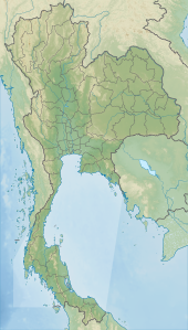
| Coordinates | 16°52′05″N 101°46′33″E / 16.86806°N 101.77583°E |
| Area | 348 km2 (134 sq mi) |
| Established | 1962 |
| Visitors | 86,259 (in 2019) |
| Governing body | Department of National Parks, Wildlife and Plant Conservation |


Phu Kradueng National Park (Thai: อุทยานแห่งชาติภูกระดึง), in the Si Than sub-district of Amphoe Phu Kradueng, Loei Province, is one of the best known national parks of Thailand. It has a high point of 1,316 m (4318 ft) elevation at Khok Moei. It was proclaimed a national park on 23 November 1962, making it the second national park of Thailand after Khao Yai National Park.[1]
The park is closed to visitors during the rainy season (1 June - 30 September).[2]
- ^ Cite error: The named reference
DNPwas invoked but never defined (see the help page). - ^ "Phu Kradueng National Park". Tourism Authority of Thailand (TAT). Retrieved 2 November 2015.
© MMXXIII Rich X Search. We shall prevail. All rights reserved. Rich X Search
