Back مقاطعة بوكاهونتاس (فرجينيا الغربية) Arabic Pocahontas County, West Virginia BAR Покахонтас (окръг, Западна Вирджиния) Bulgarian পোকাহোন্টাস কাউন্টি, ৱেস্ট ভার্জিনিয়া BPY Pocahontas Gông (West Virginia) CDO Покахонтас (гуо, Малхбузен Виргини) CE Pocahontas County (kondado sa Tinipong Bansa, West Virginia) CEB Pocahontas County, Gorllewin Virginia Welsh Pocahontas County (West Virginia) German Kantono Pocahontas (Okcidenta Virginio) Esperanto
Pocahontas County | |
|---|---|
Pocahontas County Courthouse in Marlinton | |
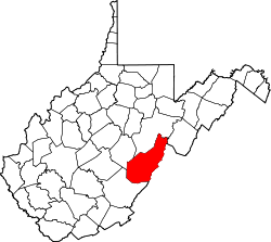
 Location of Pocahontas County in West Virginia | |
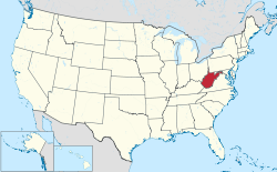
 West Virginia's location within the U.S. | |
| Coordinates: 38°19′N 80°01′W / 38.32°N 80.01°W | |
| Country | |
| State | |
| Founded | December 21, 1821 |
| Named for | Pocahontas |
| Seat | Marlinton |
| and largest town | |
| Government | |
| • County Commission President | Walt Helmick [1] |
| • County Commission | Jamie Walker John Rebinski |
| Area | |
| • Total | 2,440 km2 (942 sq mi) |
| • Land | 2,400 km2 (940 sq mi) |
| • Water | 4 km2 (1.5 sq mi) 0.2% |
| • Rank | 3rd |
| Population (2020) | |
| • Total | 7,869 |
| • Estimate (2021) | 7,841 |
| • Rank | 47th |
| • Density | 3.2/km2 (8.4/sq mi) |
| Time zone | UTC−5 (Eastern) |
| • Summer (DST) | UTC−4 (EDT) |
| Area code(s) | 304, 681 |
| Congressional district | 1st |
| Senate district | 11th |
| House of Delegates district | 46th, 66th |
| Website | https://pocahontascountycommission.com/ |
Pocahontas County is a county located in the eastern part of the U.S. state of West Virginia. As of the 2020 census, the population was 7,869.[2] Its county seat is Marlinton.[3] The county was established in 1821. It is named after the daughter of the Powhatan chief of the Native Americans in the United States who came from Jamestown, Virginia. She married an English settler, and their children became ancestors of many of the First Families of Virginia.[4]
Pocahontas County is the home to the Green Bank Observatory and is part of the National Radio Quiet Zone.
- ^ "Pocahontas County Commission". Pocahontas County.
- ^ "State & County QuickFacts". United States Census Bureau. Retrieved October 20, 2022.
- ^ "Find a County". National Association of Counties. Retrieved June 7, 2011.
- ^ "Archived copy". Archived from the original on September 23, 2001. Retrieved February 4, 2013.
{{cite web}}: CS1 maint: archived copy as title (link), West Virginia Culture
© MMXXIII Rich X Search. We shall prevail. All rights reserved. Rich X Search


