Back بريست ريفير Arabic بريسانت ريفير ARZ پریست ریور، آیداهو AZB Прийст Ривър Bulgarian Priest River Catalan Прист-Ривер (Айдахо) CE Priest River (lungsod) CEB Priest River, Idaho Welsh Priest River DAG Priest River Spanish
Priest River, Idaho | |
|---|---|
 | |
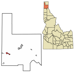
 Location of Priest River in Bonner County, Idaho. | |
| Coordinates: 48°11′0″N 116°54′34″W / 48.18333°N 116.90944°W | |
| Country | United States |
| State | Idaho |
| County | Bonner |
| Government | |
| • Mayor | Jim Martin |
| Area | |
| • Total | 3.70 sq mi (9.58 km2) |
| • Land | 3.55 sq mi (9.20 km2) |
| • Water | 0.14 sq mi (0.37 km2) |
| Elevation | 2,139 ft (652 m) |
| Population | |
| • Total | 1,751 |
| • Estimate (2019)[3] | 1,893 |
| • Density | 532.64/sq mi (205.67/km2) |
| Time zone | UTC-8 (Pacific (PST)) |
| • Summer (DST) | UTC-7 (PDT) |
| ZIP code | 83856 |
| Area code(s) | 208, 986 |
| FIPS code | 16-65530 |
| GNIS feature ID | 0397069 |
| Website | priestriver-id |
Priest River is a city in Bonner County, Idaho. The population was 1,696 at the 2020 census,[4] and 1,751 at the 2010 census.[5] Located in the Idaho Panhandle region of the state, the city is at the mouth of the Priest River on the Pend Oreille River.
- ^ "2019 U.S. Gazetteer Files". United States Census Bureau. Retrieved July 9, 2020.
- ^ Cite error: The named reference
wwwcensusgovwas invoked but never defined (see the help page). - ^ Cite error: The named reference
USCensusEst2019CenPopScriptOnlyDirtyFixDoNotUsewas invoked but never defined (see the help page). - ^ "Explore Census Data". data.census.gov. Retrieved May 23, 2024.
- ^ Spokesman-Review Archived 2016-03-04 at the Wayback Machine - 2010 census - Priest River, Idaho - accessed 2011-12-13
© MMXXIII Rich X Search. We shall prevail. All rights reserved. Rich X Search