Back Carolina (Provinz) German Provinco Karolino Esperanto Provincia de Carolina Spanish Province de Caroline French פרובינציית קרוליינה HE Provinsi Carolina ID Provincia della Carolina Italian カロライナ植民地 Japanese 캐롤라이나 식민지 Korean Carolina (provincie) Dutch
| Province of Carolina | |||||||||||||||
|---|---|---|---|---|---|---|---|---|---|---|---|---|---|---|---|
| Province of Great Britain | |||||||||||||||
| 1663–1712 | |||||||||||||||
|
British Red Ensign | |||||||||||||||
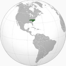
 Location of Carolina in North America | |||||||||||||||
| Anthem | |||||||||||||||
| "God Save the King"[a] | |||||||||||||||
| Capital | Charlestown | ||||||||||||||
| Area | |||||||||||||||
| • Coordinates | 34°48′17″N 79°40′31″W / 34.80472°N 79.67528°W | ||||||||||||||
| Government | |||||||||||||||
| • Type | Proprietary colony | ||||||||||||||
| • Motto | Domitus Cultoribus Orbis (Latin) "Tamed by the cultivators of the world" | ||||||||||||||
| Lords Proprietor | |||||||||||||||
• 1663 | |||||||||||||||
| Governor | |||||||||||||||
• 1692–1693 | Philip Ludwell (first) | ||||||||||||||
• 1710–1712 | Robert Gibbes (last) | ||||||||||||||
| Legislature | |||||||||||||||
• Upper house | Grand Council | ||||||||||||||
• Lower house | Parliament of Carolina | ||||||||||||||
| Historical era | Stuart era | ||||||||||||||
• Charter of Carolina | March 24, 1663 | ||||||||||||||
• Partition of Carolina | January 24, 1712 | ||||||||||||||
| |||||||||||||||
| Today part of | United States
| ||||||||||||||
The Province of Carolina was a province of the Kingdom of England (1663–1707) and later the Kingdom of Great Britain (1707–1712) that existed in North America and the Caribbean from 1663 until the Carolinas were partitioned into North and South on January 24, 1712.
The North American Carolina province consisted of all or parts of present-day Alabama, Florida, Georgia, Mississippi, North Carolina, South Carolina, and Tennessee.[2]
- ^ Berry, Ciara (January 15, 2016). "National Anthem". The Royal Family. Retrieved June 4, 2016.
- ^ Poore, Ben. Perley, ed. (1877). The Federal and State Constitutions, Colonial Charters, and Other Organic Laws of the United States, Volume II. Washington: Government Printing Office. pp. 1382–1390. OCLC 958743486 – via Internet Archive.
Cite error: There are <ref group=lower-alpha> tags or {{efn}} templates on this page, but the references will not show without a {{reflist|group=lower-alpha}} template or {{notelist}} template (see the help page).
© MMXXIII Rich X Search. We shall prevail. All rights reserved. Rich X Search
