Qazaza
قزازة Kezazeh, Kerazeh | |
|---|---|
![Remains of the Wadi al-Sarar Railway Station, on the Jaffa–Jerusalem railway line, located 3 km (2 mi) due north of the village.[1]](http://upload.wikimedia.org/wikipedia/commons/thumb/f/f7/NahalSorekStation.jpg/200px-NahalSorekStation.jpg) Remains of the Wadi al-Sarar Railway Station, on the Jaffa–Jerusalem railway line, located 3 km (2 mi) due north of the village.[1] | |
| Etymology: from personal name[2] | |
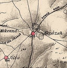
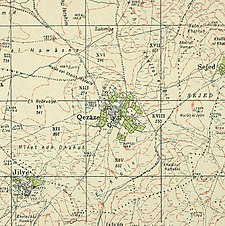
A series of historical maps of the area around Qazaza (click the buttons) | |
Location within Mandatory Palestine | |
| Coordinates: 31°46′44″N 34°52′34″E / 31.77889°N 34.87611°E | |
| Palestine grid | 138/131 |
| Geopolitical entity | Mandatory Palestine |
| Subdistrict | Ramle |
| Date of depopulation | 9–10 July 1948[3] |
| Area | |
| • Total | 18,829 dunams (18.829 km2 or 7.270 sq mi) |
| Population (1945) | |
| • Total | 940 |
| Cause(s) of depopulation | Influence of nearby town's fall |
| Current Localities | Israel Defense Forces base |
Qazaza (Arabic: قزازة) was a Palestinian village in the Ramle Subdistrict of Mandatory Palestine, located 19 kilometers (12 mi) south of Ramla. It was depopulated in 1948.
© MMXXIII Rich X Search. We shall prevail. All rights reserved. Rich X Search


