Back Rhanbarthau o Sydney Welsh אזורי סידני HE Wilayah di Sydney ID سڈنی دے علاقے PNB Regiões de Sydney Portuguese سڈنی کے علاقے Urdu

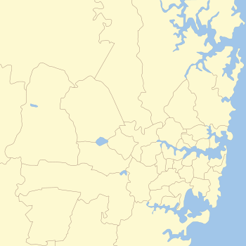
The metropolis of Greater Sydney in New South Wales, Australia, is informally subdivided into a number of geographic regions. The geographical definition of Greater Sydney spans across 33 local government areas and includes the Blue Mountains in the west, the Northern Beaches and the Hawkesbury in the north, the Royal National Park, the Wollondilly and Macarthur in the south, and Botany Bay in the east. These areas sometimes, but not always, roughly coincide with official boundaries of suburbs, local government authorities, or cadastral units (used for land title purposes), and some of the customary regions do not have well defined boundaries at all. Some commonly referred to regions overlap: for example, Canterbury-Bankstown is often referred to as a region, but it is also part of the South Western Sydney region. The regions themselves are not used as a formal jurisdiction, and generally do not have administrative or legislative bodies, although some regions are coterminous with a local government area, and in a number of regions that include multiple local government areas, Regional Organisations of Councils have been established that represent the councils in the region.
For government planning purposes, the metropolis of Sydney is divided in other ways, including into "districts" or "cities".[1]
- ^ Greater Sydney Commission, Greater Sydney Region Plan, March 2018, p.25
© MMXXIII Rich X Search. We shall prevail. All rights reserved. Rich X Search
