Back نهر ديروينت (نهر فى يوركشير) ARZ River Derwent (suba sa Hiniusang Gingharian, Inglatera, lat 53,75, long -0,95) CEB Afon Derwent (Swydd Efrog) Welsh River Derwent (River Ouse) German Río Derwent Spanish Derwent (Yorkshire) French Deruventio (flumen Isuriae) Latin Derwent i Yorkshire NN Derwent (rzeka w Yorkshire) Polish Rio Derwent Portuguese
| Derwent Darwent – archaically | |
|---|---|
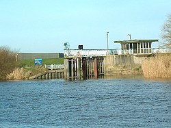
 Barmby on the Marsh Tidal Barrage at the mouth of the River Derwent | |
 Map of the Catchment Area of the River Derwent | |
| Location | |
| Country | England |
| Region | Yorkshire |
| Physical characteristics | |
| Source | Fylingdales Moor |
| • location | North York Moors, Yorkshire, England |
| • coordinates | 54°22′50.10″N 0°37′23.79″W / 54.3805833°N 0.6232750°W |
| • elevation | 260 m (850 ft) |
| Mouth | Barmby Barrage |
• location | Barmby on the Marsh, Yorkshire, England |
• coordinates | 53°44′58″N 0°58′08″W / 53.74944°N 0.96889°W |
• elevation | 10 m (33 ft) |
| Length | 115.1 km (71.5 mi) |
| Basin size | 2,057 km2 (794 sq mi) |
| Basin features | |
| Tributaries | |
| • left | River Rye, Yorkshire |
| • right | Pocklington Canal, River Hertford |
| Designation | |
| Official name | Lower Derwent Valley |
| Designated | 17 July 1985 |
| Reference no. | 301[1] |
The Derwent is a river in Yorkshire in the north of England. It flows from Fylingdales Moor in the North York Moors National Park, east then southwards as far as its confluence with the River Hertford then westwards through the Vale of Pickering, south through Kirkham Gorge and the Vale of York, joining the River Ouse at Barmby on the Marsh. The confluence is unusual in that the Derwent converges on the Ouse at a shallow angle in an upstream direction.
The river used to flow further east, its old course entering the Ouse east of Howden.
The River Derwent catchment area includes the Upper Derwent, River Rye, River Hertford, Bielby Beck and Pocklington Canal and their tributaries. It covers an area of 2,057 square kilometres and includes the towns of Stamford Bridge, Malton, Pickering, Helmsley, Filey and Scarborough. The area is bounded by the Cleveland Hills, North York Moors and Hambleton Hills to the north, the Yorkshire Wolds and the coast to the east, the Vale of York to the west and the River Ouse and Humber Estuary to the south. The area around the river is primarily rural in nature with grazing moorland in the upland areas and a variety of agricultural uses at lower levels. There are large areas of designated conservation sites throughout the area. There are two titles named after the River Derwent in the British peerage, Viscount FitzAlan of Derwent which is extinct and Baron Derwent.
- ^ "Lower Derwent Valley". Ramsar Sites Information Service. Retrieved 25 April 2018.
© MMXXIII Rich X Search. We shall prevail. All rights reserved. Rich X Search