| River Washburn | |
|---|---|
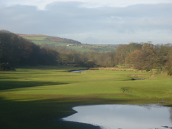
 The River Washburn approaching Lindley Wood Reservoir | |
| Location | |
| Country | England |
| Physical characteristics | |
| Source | |
| • location | Washburn Head |
| • coordinates | 54°3′46″N 1°50′50″W / 54.06278°N 1.84722°W |
| • elevation | 391 m (1,283 ft) |
| Mouth | |
• location | River Wharfe near Pool |
• coordinates | 53°54′39″N 1°39′6″W / 53.91083°N 1.65167°W |
• elevation | 49 m (161 ft) |
| Length | 26 km (16 mi) |
| Basin size | 87.3 km2 (33.7 sq mi)[1] |
The River Washburn is a river in Yorkshire, England. It originates high in the Yorkshire Dales and ends where it meets the River Wharfe. It lies within the Nidderdale Area of Outstanding Natural Beauty.[2]
- ^ "Washburn Statistics". National River Flow Archives. Centre for Ecology & Hydrology. Retrieved 18 February 2011.
- ^ "Upper Washburn Valley Landscape Character Assessment" (PDF). Retrieved 27 August 2017.
© MMXXIII Rich X Search. We shall prevail. All rights reserved. Rich X Search
