Back مقاطعة روكينغهام (نيو هامبشاير) Arabic Rockingham County, New Hampshire BAR Рокингам (окръг, Ню Хампшър) Bulgarian রকিংহাম কাউন্টি, নিউ হ্যাম্পশায়ার BPY Rockingham Gông (New Hampshire) CDO Рокингем (гуо, Нью-Гэмпшир) CE Rockingham County (kondado sa Tinipong Bansa, New Hampshire) CEB Rockingham County, New Hampshire Welsh Rockingham County (New Hampshire) German Kantono Rockingham (Nov-Hampŝiro) Esperanto
Rockingham County | |
|---|---|
 Aerial view of Portsmouth | |
 Location within the U.S. state of New Hampshire | |
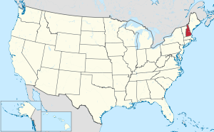
 New Hampshire's location within the U.S. | |
| Coordinates: 42°57′46″N 71°04′39″W / 42.962872°N 71.077621°W | |
| Country | |
| State | |
| Founded | 1769 |
| Named for | Charles Watson-Wentworth, 2nd Marquess of Rockingham |
| Seat | Brentwood |
| Largest town | Derry |
| Area | |
| • Total | 795.2 sq mi (2,060 km2) |
| • Land | 695.4 sq mi (1,801 km2) |
| • Water | 99.9 sq mi (259 km2) 12.6% |
| Population (2020) | |
| • Total | 314,176 |
| • Estimate (2022) | 319,424 |
| • Density | 400/sq mi (150/km2) |
| Time zone | UTC−5 (Eastern) |
| • Summer (DST) | UTC−4 (EDT) |
| Congressional districts | 1st, 2nd |
| Website | www |
Rockingham County is a county in the U.S. state of New Hampshire. As of the 2020 census, the population was 314,176,[1] making it New Hampshire's second-most populous county. The county seat is Brentwood.[2] Rockingham County is part of the Boston-Cambridge-Newton, MA-NH Metropolitan Statistical Area and the greater Boston-Worcester-Providence, MA-RI-NH-CT Combined Statistical Area. Per the 2020 census, it was New Hampshire's fastest growing county from 2010 to 2020.[3]
As of 2014–2018 estimates from the American Community Survey, Rockingham County was the fourth- wealthiest county in New England, with a median household income of $90,429.[4]
- ^ "State & County QuickFacts". United States Census Bureau. Retrieved May 17, 2023.
- ^ "Find a County". National Association of Counties. Retrieved June 7, 2011.
- ^ "Decennial Census P.L. 94-171 Redistricting Data".
- ^ "American Community Survey (ACS)". The United States Census Bureau. Retrieved May 5, 2021.
© MMXXIII Rich X Search. We shall prevail. All rights reserved. Rich X Search

