| San Luis Rey River | |
|---|---|
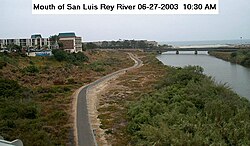
 River mouth from North Coast Hwy bridge. | |
| Location | |
| Country | United States |
| State | California |
| Physical characteristics | |
| Source | Lake Henshaw reservoir |
| • location | Confluence of West Fork San Luis Rey River and Buena Vista Creek, Cleveland National Forest, San Diego County |
| • coordinates | 33°24′02″N 116°37′26″W / 33.40056°N 116.62389°W[1] |
| • elevation | 2,627 ft (801 m) |
| Mouth | Pacific Ocean |
• location | Oceanside, San Diego County |
• coordinates | 33°12′08″N 117°23′32″W / 33.20222°N 117.39222°W[1] |
• elevation | 0 ft (0 m) |
| Length | 69 mi (111 km), East-west[2] |
| Basin size | 557 sq mi (1,440 km2)[3] |
| Discharge | |
| • location | Oceanside[3] |
| • average | 36.3 cu ft/s (1.03 m3/s)[3] |
| • minimum | 0 cu ft/s (0 m3/s) |
| • maximum | 25,700 cu ft/s (730 m3/s) |
| Basin features | |
| Tributaries | |
| • left | Buena Vista Creek |
| • right | West Fork San Luis Rey River, Pauma Creek |
The San Luis Rey River is a river in northern San Diego County, California.
The river's headwaters are in the Palomar Mountain Range and Cleveland National Forest, near Palomar Mountain and the Santa Rosa Mountains. The river mouth, on the Pacific Ocean, is in northern Oceanside. The San Luis Rey River bike path runs along it for its last 9 miles (14 km).
The river is over 69 miles (111 km) long[4] and drains 562 square miles (1,460 km2). There is little water in the river during most of the year, but it can have very large flows during winter storms.
- ^ a b "San Luis Rey River". Geographic Names Information System. United States Geological Survey, United States Department of the Interior. 1981-01-19. Retrieved 2010-09-12.
- ^ Length measured in Google Earth using path measure tool; measured to longest source (includes Fry Creek and West Fork San Luis Rey River
- ^ a b c "Water-Data Report 2009: USGS Gage #11042000 on the San Luis Rey River at Oceanside, CA" (PDF). National Water Information System. U.S. Geological Survey. 1930–2009. Retrieved 2010-09-12.
- ^ U.S. Geological Survey. National Hydrography Dataset high-resolution flowline data. The National Map, accessed March 16, 2011
© MMXXIII Rich X Search. We shall prevail. All rights reserved. Rich X Search
