Back مقاطعة ساري Arabic شهرستان ساری ARZ Sari şəhristanı Azerbaijani ساری بؤلگهسی AZB Shahrestān-e Sārī CEB شارستانی ساری CKB Sari (Verwaltungsbezirk) German شهرستان ساری Persian ساري شأرستان GLK Shahrestān di Sari Italian
Sari County
Persian: شهرستان ساری | |
|---|---|
 Location of Sari County in Mazandaran province (center right, purple) | |
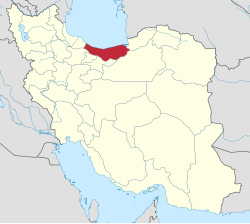
 Location of Mazandaran province in Iran | |
| Coordinates: 36°24′N 53°25′E / 36.400°N 53.417°E[1] | |
| Country | |
| Province | Mazandaran |
| Capital | Sari |
| Districts | Central, Chahardangeh, Dodangeh, Kolijan Rostaq, Rudpey, Rudpey-ye Shomali |
| Area | |
| • Total | 3,685.30 km2 (1,422.90 sq mi) |
| Population (2016) | |
| • Total | 504,298 |
| • Density | 140/km2 (350/sq mi) |
| Time zone | UTC+3:30 (IRST) |
| Sari County can be found at GEOnet Names Server, at this link, by opening the Advanced Search box, entering "-3196738" in the "Unique Feature Id" form, and clicking on "Search Database". | |
Sari County (Persian: شهرستان ساری) is in Mazandaran province, Iran. Its capital is the city of Sari.[3]
- ^ OpenStreetMap contributors (25 May 2024). "Sari County" (Map). OpenStreetMap (in Persian). Retrieved 25 May 2024.
- ^ Management and Planning Organization of Mazandaran, 2006
- ^ Habibi, Hassan (12 September 1990). "Approval of the organization and chain of citizenship of the elements and units of the divisions of Mazandaran province, centered in Sari city". Lamtakam (in Persian). Ministry of Interior, Defense Political Commission of the Government Council. Archived from the original on 14 January 2024. Retrieved 14 January 2024.
© MMXXIII Rich X Search. We shall prevail. All rights reserved. Rich X Search