40°06′11″N 75°19′30″W / 40.10306°N 75.32500°W
Schuylkill River Bridge | |
|---|---|
 | |
| Coordinates | 40°06′11″N 75°19′30″W / 40.1031°N 75.325°W |
| Carries | |
| Crosses | Schuylkill River |
| Characteristics | |
| Total length | 1,224 feet (373 m) |
| History | |
| Opened | 1954 |
| Location | |
 | |
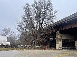
The Schuylkill River Bridge (also known as the Diamond Run Viaduct)[1] is a bridge that carries the Pennsylvania Turnpike across the Schuylkill River.[2]
This section of the Pennsylvania Turnpike, which is located between two major interchanges, became "the most heavily traveled four-lane section of the turnpike" following its opening, according to the Pennsylvania Turnpike Commission.[3]
- ^ "Diamond Run Viaduct".
- ^ "Turnpike to hold meeting on bridge improvements." Philadelphia, Pennsylvania: The Philadelphia Inquirer, April 12, 1993, p. 14 (subscription required).
- ^ "Pa. Turnpike work is set to begin." Philadelphia: Pennsylvania: The Philadelphia Inquirer, March 13, 1998, p. 128 (subscription required).
© MMXXIII Rich X Search. We shall prevail. All rights reserved. Rich X Search
