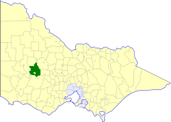
| Shire of Stawell Victoria | |||||||||||||||
|---|---|---|---|---|---|---|---|---|---|---|---|---|---|---|---|
 Location in Victoria | |||||||||||||||
| Population | 2,620 (1992)[1] | ||||||||||||||
| • Density | 1.0054/km2 (2.604/sq mi) | ||||||||||||||
| Established | 1861 | ||||||||||||||
| Area | 2,606 km2 (1,006.2 sq mi) | ||||||||||||||
| Council seat | Stawell | ||||||||||||||
| Region | Grampians | ||||||||||||||
| County | Borung, Kara Kara | ||||||||||||||
| |||||||||||||||
The Shire of Stawell was a local government area about 230 kilometres (143 mi) west-northwest of Melbourne, the state capital of Victoria, Australia. The shire covered an area of 2,606 square kilometres (1,006.2 sq mi), and existed from 1861 until 1995.
Stawell itself was managed by a separate entity; the City of Stawell.
© MMXXIII Rich X Search. We shall prevail. All rights reserved. Rich X Search
