Back سميديريفو Arabic سميديريفو ARZ Смедарава Byelorussian Смэдэрэва BE-X-OLD Смедерево Bulgarian Smederevo BS Smederevo Catalan Смедерево (Серби) CE Smederevo (kapital sa distrito) CEB سمێدێرێفپڤو CKB
This article needs additional citations for verification. (December 2017) |
Smederevo
Смедерево (Serbian) | |
|---|---|
| City of Smederevo | |
|
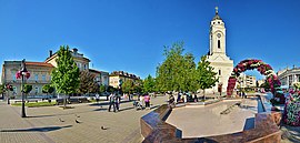
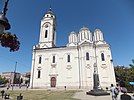
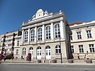
From top: Republic Square, Church of Saint George, Courthouse in Smederevo, Town hall, Smederevo Gymnasium, Smederevo Fortress, Obrenović Villa | |
 Location of the city of Smederevo within Serbia | |
| Coordinates: 44°40′N 20°56′E / 44.667°N 20.933°E | |
| Country | Serbia |
| District | Podunavlje |
| Settlements | 28 |
| Government | |
| • Mayor | Jasmina Vojinović (SNS) |
| Area | |
| • Urban | 42.03 km2 (16.23 sq mi) |
| • Administrative | 484.30 km2 (186.99 sq mi) |
| Elevation | 72 m (236 ft) |
| Population (2022 census)[1] | |
| • Rank | 14th in Serbia |
| • Urban | 59,261 |
| • Urban density | 1,400/km2 (3,700/sq mi) |
| • Administrative | 97,930 |
| • Administrative density | 200/km2 (520/sq mi) |
| Time zone | UTC+1 (CET) |
| • Summer (DST) | UTC+2 (CEST) |
| Postal code |
|
| Area code | +381(0)26 |
| Car plates | SD |
| Website | www |
Smederevo (Serbian Cyrillic: Смедерево, pronounced [smêdereʋo] ) is a city and the administrative center of the Podunavlje District in eastern Serbia. It is situated on the right bank of the Danube, about 45 kilometres (28 miles) downstream of the Serbian capital, Belgrade.
According to the 2022 census, the city has a population of 59,261, with 97,930 people living in its administrative area.
Its history starts in the 1st century BC, after the conquest of the Roman Empire, when there existed a settlement by the name of Vinceia. The modern city traces its roots back to the Late Middle Ages when it was the capital (1430–39, and 1444–59) of the last independent Serbian state before Ottoman conquest.
Smederevo is said to be the city of iron (Serbian: гвожђе / gvožđe) and grapes (грожђе / grožđe).
- ^ AGE AND SEX, publikacije.stat.gov.rs; accessed 13 July 2023.
© MMXXIII Rich X Search. We shall prevail. All rights reserved. Rich X Search


