Back South Ronaldsay CEB South Ronaldsay Czech South Ronaldsay Welsh South Ronaldsay German Νότιο Ρονάλντσι Greek Suda Ronaldsay Esperanto South Ronaldsay Spanish South Ronaldsay Basque South Ronaldsay French Raghnallsaigh Irish
| Scottish Gaelic name | Raghnallsaigh a Deas |
|---|---|
| Scots name | Sooth Ronalshee[1] |
| Old Norse name | Rǫgnvaldsey |
| Meaning of name | Old Norse for "Rognvald/Ronald's island" |
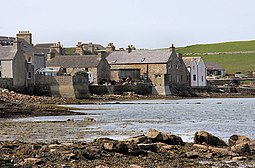
 St Margaret's Hope on South Ronaldsay | |
| Location | |
| OS grid reference | ND449899 |
| Coordinates | 58°47′N 2°57′W / 58.78°N 2.95°W |
| Physical geography | |
| Island group | Orkney |
| Area | 4,980 hectares (19.2 sq mi) |
| Area rank | 22 [2] |
| Highest elevation | Ward Hill 118 metres (387 ft) |
| Administration | |
| Council area | Orkney Islands |
| Country | Scotland |
| Sovereign state | United Kingdom |
| Demographics | |
| Population | 909[3] |
| Population rank | 16 [2] |
| Population density | 18.3 people/km2[3][4] |
| Largest settlement | St Margaret's Hope |
| References | [4][5][6] [7][8] |
South Ronaldsay (/ˈrɒnəltsiː/, also /ˈrɒnəldziː/, Scots: Sooth Ronalshee) is one of the Orkney Islands off the north coast of Scotland. It is linked to the Orkney Mainland by the Churchill Barriers, running via Burray, Glimps Holm and Lamb Holm.
- ^ "Map of Scotland in Scots - Guide and gazetteer" (PDF).
- ^ a b Area and population ranks: there are c. 300 islands over 20 ha in extent and 93 permanently inhabited islands were listed in the 2011 census.
- ^ a b National Records of Scotland (15 August 2013). "Appendix 2: Population and households on Scotland's Inhabited Islands" (PDF). Statistical Bulletin: 2011 Census: First Results on Population and Household Estimates for Scotland Release 1C (Part Two) (PDF) (Report). SG/2013/126. Retrieved 14 August 2020.
- ^ a b Haswell-Smith (2004) pp. 358–59.
- ^ "Orkney Placenames" Orkneyjar. Retrieved 16 November 2008.
- ^ Ordnance Survey: Landranger map sheet 7 Orkney (Southern Isles) (Map). Ordnance Survey. 2008. ISBN 9780319228135.
- ^ Anderson, Joseph (Ed.) (1893) Orkneyinga Saga. Translated by Jón A. Hjaltalin & Gilbert Goudie. Edinburgh. James Thin and Mercat Press (1990 reprint). ISBN 0-901824-25-9
- ^ Pedersen, Roy (January 1992) Orkneyjar ok Katanes (map) Inverness. Nevis Print.
© MMXXIII Rich X Search. We shall prevail. All rights reserved. Rich X Search
