Back Southwest (Washington, D.C.) French Sudoeste de Washington, D.C. Portuguese ساؤتھ ویسٹ (واشنگٹن، ڈی سی) Urdu 西南区 (华盛顿哥伦比亚特区) Chinese

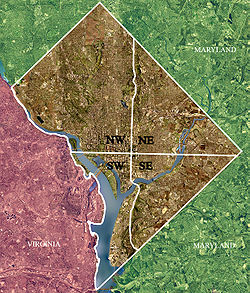
Southwest (SW or S.W.) is the southwestern quadrant of Washington, D.C., the capital of the United States, and is located south of the National Mall and west of South Capitol Street. It is the smallest quadrant of the city, and contains a small number of named neighborhoods and districts, including Bellevue, Southwest Federal Center, the Southwest Waterfront, Buzzard Point, and the military installation known as Joint Base Anacostia–Bolling.
© MMXXIII Rich X Search. We shall prevail. All rights reserved. Rich X Search