Back مقاطعة سانت برنارد (لويزيانا) Arabic St. Bernard Parish, Louisiana BAR সেন্ট বার্নার্ড পারিশ, লুইসিয়ানা BPY Séng Bernard Gông (Louisiana) CDO Saint Bernard Parish CEB St. Bernard Parish, Louisiana Welsh St. Bernard Parish German Parroquia de St. Bernard Spanish St. Bernardi vald Estonian St. Bernard parrokia (Louisiana) Basque
St. Bernard Parish | |
|---|---|
 St. Bernard Parish Courthouse | |
 Location within the U.S. state of Louisiana | |
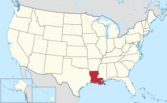
 Louisiana's location within the U.S. | |
| Coordinates: 29°53′N 89°21′W / 29.89°N 89.35°W | |
| Country | |
| State | |
| Founded | March 31, 1807 |
| Named after | Bernardo de Galvez |
| Seat | Chalmette |
| Largest community | Chalmette |
| Area | |
• Total | 2,158 sq mi (5,590 km2) |
| • Land | 378 sq mi (980 km2) |
| • Water | 1,781 sq mi (4,610 km2) 83% |
| Population (2020) | |
• Total | 43,764 |
| • Density | 115.78/sq mi (44.70/km2) |
| Time zone | UTC−6 (Central) |
| • Summer (DST) | UTC−5 (CDT) |
| Congressional districts | 1st, 2nd |
| Website | sbpg.net |
St. Bernard Parish (French: Paroisse de Saint-Bernard; Spanish: Parroquia de San Bernardo) is a parish in the U.S. state of Louisiana. The parish seat and largest community is Chalmette.[2] The parish was formed in 1807.[3] St. Bernard Parish is part of the New Orleans–Metairie metropolitan statistical area; the parish is located southeast of the city of New Orleans and comprises the Chandeleur Islands and Chandeleur Sound in the east.
St. Bernard was the fastest growing parish in Louisiana from 2010 to 2020,[4] increasing from a population of 35,897 in the 2010 census to 43,764 in 2020.[5][6] It remains at less than two-thirds of its 2000 population of 67,229, prior to Hurricane Katrina.
- ^ "U.S. Census Bureau QuickFacts: St. Bernard Parish, Louisiana". Census.gov. Retrieved November 19, 2021.
- ^ "Find a County". National Association of Counties. Retrieved June 7, 2011.
- ^ "St. Bernard Parish". Center for Cultural and Eco-Tourism. Retrieved September 6, 2014.
- ^ "2020 Population and Housing State Data". census.gov.
- ^ "State & County QuickFacts". United States Census Bureau. Archived from the original on June 6, 2011. Retrieved August 18, 2013.
- ^ "QuickFacts: St. Bernard Parish, Louisiana". U.S. Census Bureau. Retrieved August 12, 2021.
© MMXXIII Rich X Search. We shall prevail. All rights reserved. Rich X Search

