Back مقاطعة سانت لورنس (نيويورك) Arabic سانت لوارنس كاونتى (نيو يورك) ARZ St. Lawrence County, New York BAR Сейнт Лорънс (окръг) Bulgarian সেন্ট লৱরেন্স কাউন্টি, নিউ ইয়র্ক BPY Séng Lawrence Gông (New York) CDO Сент-Лоуренс (гуо, Нью-Йорк) CE St. Lawrence County CEB St. Lawrence County Czech St. Lawrence County, Efrog Newydd Welsh
St. Lawrence County | |
|---|---|
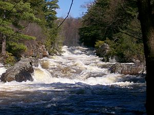
 The Raquette River in Colton, New York | |
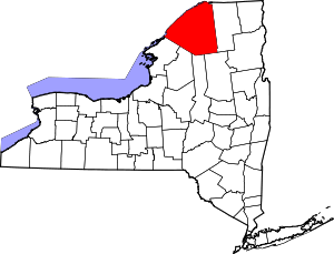
 Location within the U.S. state of New York | |
 New York's location within the U.S. | |
| Coordinates: 44°30′N 75°04′W / 44.5°N 75.07°W | |
| Country | |
| State | |
| Founded | 1802 |
| Named for | Saint Lawrence River |
| Seat | Canton |
| Area | |
| • Total | 2,821 sq mi (7,310 km2) |
| • Land | 2,680 sq mi (6,900 km2) |
| • Water | 141 sq mi (370 km2) 5.0% |
| Population (2020) | |
| • Total | 108,505 |
| • Density | 38/sq mi (15/km2) |
| Time zone | UTC−5 (Eastern) |
| • Summer (DST) | UTC−4 (EDT) |
| Congressional district | 21st |
| Website | www |
St. Lawrence County is a county in the U.S. state of New York. As of the 2020 census, the population was 108,505.[1] The county seat is Canton.[2] The county is named for the Saint Lawrence River. This was as named by early French explorer Jacques Cartier for the Christian saint Lawrence of Rome, as he visited the river on the saint's feast day. The county is part of the North Country region of the state.
St. Lawrence County comprises the Ogdensburg-Massena, NY Micropolitan Statistical Area and is New York's largest county by area.
- ^ "U.S. Census Bureau QuickFacts: St. Lawrence County, New York". United States Census Bureau. Archived from the original on July 13, 2023. Retrieved January 2, 2022.
- ^ "Find a County". National Association of Counties. Archived from the original on May 31, 2011. Retrieved June 7, 2011.
© MMXXIII Rich X Search. We shall prevail. All rights reserved. Rich X Search

