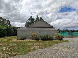
Swannanoa | |
|---|---|
Village | |
 View of Swannanoa Hall across the road from the primary school | |
 | |
| Coordinates: 43°23′S 172°28′E / 43.383°S 172.467°E | |
| Country | |
| Island | South Island |
| Region | Canterbury |
| Ward | Oxford-Ohoka Ward |
| Community | Oxford-Ohoka Community |
| Electorates |
|
| Government | |
| • Territorial Authority | Waimakariri District Council |
| • Regional council | Environment Canterbury |
| • Mayor of Waimakariri | Dan Gordon |
| • Waimakariri MP | Matthew Doocey |
| • Te Tai Tonga MP | Tākuta Ferris |
| Area | |
| • Total | 61.77 km2 (23.85 sq mi) |
| Population (June 2023)[2] | |
| • Total | 1,040 |
| • Density | 17/km2 (44/sq mi) |
| Time zone | UTC+12 (NZST) |
| • Summer (DST) | UTC+13 (NZDT) |
Swannanoa is a small village in Canterbury, New Zealand. It is located 35 kilometres northwest of the largest city in the South Island, Christchurch. The area has an estimated population of 1,040[3] with 280 pupils enrolled in the primary school.[4][5] The population is slowly increasing due to new subdivisions being developed there and in neighbouring Mandeville North.
- ^ Cite error: The named reference
Areawas invoked but never defined (see the help page). - ^ "Population estimate tables - NZ.Stat". Statistics New Zealand. Retrieved 25 October 2023.
- ^ "Subnational population estimates (RC, SA2), by age and sex, at 30 June 1996-2021 (2021 boundaries)". nzdotstat.stats.govt.nz. Retrieved 23 December 2021.
- ^ Counts, Education. "Ministry of Education - Education Counts". www.educationcounts.govt.nz. Retrieved 23 December 2021.
- ^ "Swannanoa School". Swannanoa School. Retrieved 23 December 2021.
© MMXXIII Rich X Search. We shall prevail. All rights reserved. Rich X Search
